Białopole (Bogatynia)
| Bialopole | ||
|---|---|---|
 Help on coat of arms |
|
|
| Basic data | ||
| State : | Poland | |
| Voivodeship : | Lower Silesia | |
| Powiat : | Zgorzelec | |
| Geographic location : | 50 ° 53 ' N , 14 ° 54' E | |
| Residents : | 130 | |
| Telephone code : | (+48) 75 | |
| License plate : | DZG | |
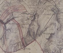
Białopole (German Sommerau ) is a Polish village with around 130 inhabitants in the municipality of Bogatynia in the powiat Zgorzelecki of the Lower Silesian Voivodeship .
Geographical location
The village lies between Sieniawka and Opolno Zdrój and belongs to the Gmina Bogatynia . It is bounded in the north by the Turów opencast mine and in the south by the border with the Czech Republic over the Heideberg (Czech: Vřesový vrch ) .
history
The place was first mentioned in 1381 as a bush farm . Another settlement arose south-east of the Buschvorwerk, which, like the Buschvorwerk, belonged to the Oberullersdorf rulership . The small town that was named Sommerau had its own local jurisdiction. The Sommerauer were parish in Reibersdorf . In 1773 the Lords of Kyaw sold the Oberullersdorf manor to the Einsiedel , who united it with the Reibersdorf rulers. In 1847 Sommerau had 218 inhabitants. After the abolition of the manors in Saxony , Sommerau formed its own municipality in the Zittau district administration from 1856 onwards , while the bushworks became part of the Oberullersdorf municipality.
In the forest west of the village there was a spruce of rare growth in the 18th and 19th centuries. The upper side branches of the badly bent tree had developed into smaller vertical trunks over the years, so that it was very reminiscent of a harp. The Sommerau harp was a popular excursion destination and object of artistic representation until it overturned in a storm in 1895.
During the inflationary period, the owner of the farm, Ewald Geißler, built a large wind turbine on his farm, which covered his family's electricity needs. In 1930 there were 254 residents in Sommerau, which at that time consisted of 45 houses with an inn. In 1938 a customs house was inaugurated on the road in the Bohemian Kohlige , whose function became superfluous after the annexation of the Sudetenland and was never used again by customs after the war.
After 1945 the place was expelled from Poland and the German residents. With the expansion of the open-cast mine and the beginning of the demolition of Rybarzowice, the last building of which fell victim to open-cast lignite mining on July 25, 2000 , the connecting road from Zittau / Sieniawka to Bogatynia has been relocated south around the mine since the 1980s and now runs through Białopole.
literature
- Tilo Böhmer, Marita Wolff: In the Zittauer Zipfel. Historical foray through Reichenau and its surroundings. Lusatia-Verlag, Bautzen 2001, ISBN 3-929091-85-2 .
Web links
- Sommerau in the Digital Historical Directory of Saxony
- Internet portal


