Bischberg (Aschaffenburg)
| Bischberg | ||
|---|---|---|
|
Bischberg |
||
| height | 188 m above sea level NHN | |
| location | Bavaria , Germany | |
| Mountains | Spessart | |
| Dominance | 0.8 km → Sternberg | |
| Notch height | 25 m | |
| Coordinates | 49 ° 57 '12 " N , 9 ° 8' 5" E | |
|
|
||
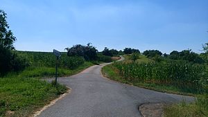
The Bischberg , also called Ludwigshöhe , is 188 m above sea level. NHN high mountain in Aschaffenburg in Bavaria .
geography
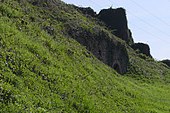
The Bischberg is located on the right bank of the Main between the Aschaffenburg districts of Schweinheim and Obernau . To the north is the Obernau colony . At its peak is above the national road 2309 and the railway line Aschaffenburg Miltenberg the Ludwig temple . Only its western slopes are forested. The protected landscape component "Bischberg-Westhang", LB-01226, lies towards the Main. The dry stone walls there date from the time of viticulture, which ended at the end of the 19th century. The Erbig (285 m) joins in the southeast . In between there are orchards that are designated as FFH protected areas.
The Bischbergstrasse , the Bischbergweg and the Obere Bischbergweg in Aschaffenburg are named after the Bischberg .
Ludwigstempel
The Ludwigstempel is a pentagon-shaped viewing pavilion on the summit plateau of the Bischberg. It was built in its first version in July / August 1879 by master locksmith Michael Hock on behalf of the Aschaffenburg Beautification Association. The Beautification Association named the pavilion after the Bavarian King Ludwig I , because Ludwig , who is receptive to natural beauty, is said to have particularly loved this vantage point. In 1937 the first Ludwigstempel had to give way to an artillery observation bunker in the Wetterau-Main-Tauber position and was quickly transferred to the pheasantry , where it was damaged in World War II and removed in 1972.
Above the filled rubble of the bunker, which was blown up in 1947, there is a reconstruction built by the city of Aschaffenburg in 1980 , which, however, has one more column than can be seen in the adjacent illustration. The view from the Ludwigstempel has hardly lost any of its original charm. The view goes to the districts of Obernau, Nilkheim and Leider, the old town with the Johannisburg Castle, to Odenwald, Taunus and Spessart, up the Main to Elsenfeld and down to the skyline of Frankfurt.
Architectural monuments
On the southern and eastern edge of the Bischberg there are listed wayside shrines with the monument numbers D-6-61-000-340, D-6-61-000-342 and D-6-61-000-343.


