Bleichenberg
| Bleichenberg | ||
|---|---|---|
|
Schlösschen Vorder-Bleichenberg |
||
| height | 502 m above sea level M. | |
| location | Biberist, Canton of Solothurn, Switzerland | |
| Dominance | 1.71 km → Chrüzberg | |
| Notch height | 43 m ↓ north of Biberist | |
| Coordinates | 609 493 / 226754 | |
|
|
||
| Type | Molasse hill | |
| rock | Molasse covered with moraine debris | |
| Age of the rock | Tertiary | |
| Development | Hiking trails | |
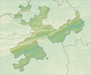
The Bleichenberg is a hill in Biberist in the canton of Solothurn in Switzerland .
geography
The highest point of the approximately two kilometer long hill is at an altitude of 502 m above sea level. M. The hill is used for agriculture with agriculture, cattle breeding and fruit growing. There is a forest area in the northeast. In the north, the Bleichenberg borders on Zuchwil . The Emme flows to the east of the hill . The A5 runs in a tunnel below the Bleichenberg .
The Biberister district of Bleichenberg is located on the southern slope .
use
- The castle of Vorder-Bleichenberg , built by the von Roll family at the beginning of the 17th century, belongs to the municipality of Biberist. It was restored in 1971 and is now an art exhibition and concert venue.
- In 1738 Viktor August von Roll built the Hinter-Bleichenberg as a summer villa. From 1872 Elisabeth Hänggi expanded the house and laid out a park in the French style. She bequeathed it to the Ingebohl Sisters with the stipulation that they run an old people's home there for the rich and poor of every denomination and that they use the name St. Elisabeth. In 1900 a small church was built and in 1991 a modern home building with 40 rooms.
- In 1937 the Gotthelfhaus was opened as a child psychiatric transit and observation station. It was the first ward in the canton that was separated from adult psychiatry. The medical management was under Dr. Moritz Tramer . From 1983 to 2005 there was also a school home. The house was used by the Solothurn Free Elementary School from 2007 to 2010 and subsequently converted into apartments.
- At the highest point of the hill there is a water reservoir where the municipalities of Derendingen , Zuchwil and Biberist hold the August 1st celebration together .
- The cultural landscape also functions as a local recreation area, accessible e.g. B. from the RBS bus stop S: t Elisabethen.
Others
- The Zuchwil cemetery Bleichenberg was inaugurated on September 15, 1972. It stands on the Birchi hill, near the castle of Vorder-Bleichenberg.
- The former Bleichenberg station on the Solothurn – Worblaufen- Bern line was closed in December 2008 and replaced by a bus line.
Individual evidence
- ↑ Schlösschen Vorder-Bleichenberg ( Memento of the original from October 20, 2013 in the Internet Archive ) Info: The archive link was inserted automatically and has not yet been checked. Please check the original and archive link according to the instructions and then remove this notice.
- ↑ St. Elisabethen (PDF file; 301 kB)
- ↑ 150 Years of Psychiatry in the Canton of Solothurn, A Long Way into the Future, 1860–2010 (PDF file; 1.2 MB)
- ↑ Biberister Dorfzytig 01-2007 (PDF file; 1.1 MB)
- ↑ Zuchwil, Spiegelbilder einer Wasserämter Dorfes, No. 3, 1996
- ↑ Biberister Dorfzytig 05-2008 (PDF file; 1022 kB)


