Birchi
| Birchi | ||
|---|---|---|
|
Birchi vom Westen, February 2012 |
||
| height | 481 m above sea level M. | |
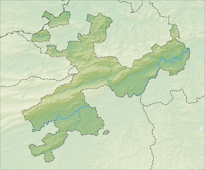
| location | Zuchwil, Canton of Solothurn, Switzerland | |
| Dominance | 0.57 km → Bleichenberg | |
| Notch height | 11 m ↓ Staatshof | |
| Coordinates | 608 860 / 227680 | |
|
|
||
| Type | Molasse hill | |
| rock | Molasse covered with moraine | |
| Age of the rock | Tertiary | |
| Development | Hiking trails | |
Birchi is a wooded hill and a local recreation area and a district in the south of Zuchwil , Switzerland .
geography
The highest point of the hill is 481 m above sea level. M. and thus almost 50 m higher than the Zuchwil village center. The north slope is quite steep. In the southeast, the hill borders the Bleichenberg in the neighboring municipality of Biberist , into which some foothills of the Birchi also extend. In the west the hill turns into the Äspli-Bühl-Terrassen. On these terraces, in the corridors Birchiacker, Gerstenacker, Leutschenacker, Engiacker, Oberfeld and Dürrenbrüel, there is the Zuchwil part of the village of Birchi. The forest area is about 0.15 km².
geology
The Birchi- Bleichenberg - Dittiberg range of hills is part of the same anticline as the northern Bucheggberg . It consists of tertiary molasses . Marl was spotted when building the road on Birchihügel . In the ice ages this molasse was covered with a moraine layer. Birchi was separated from the Bucheggberg by a late Ice Age branch of the Emme through the Engi Gully.
history
Origin of the name
The name Birchi is of Alemannic origin and also exists elsewhere. It probably means birch
Settlement history
To the west of the Birchiwald, the current Bleichenbergstrasse and Bühlstrasse existed in 1901, but no houses. The land was probably used intensively for agriculture, as the field names show. A railway settlement was built around Erlenweg. Other buildings were also built, so that in 1938 many single and multi-family houses were distributed over the terrace. Most of the houses in Birchi were built later.
Recreation area
The forest owner is the Zuchwil community . The forest consists of various deciduous and coniferous trees, has hiking trails and a bird pond. It can be easily reached by public transport , Birchi bus stop.
Others
Some facilities, such as a motorway tunnel ( A5 ) and a specialist retail center to the east , are named after the Birchi.
swell
- ↑ a b Zuchwil map, 1: 5000, 2008
- ↑ a b National map of Switzerland , 1127 Solothurn, 1: 25000, 2006
- ↑ Heinz Rudolf von Rohr: Solothurn, contributions to the analysis of the geological-morphological and cultural-geographic structure ... , Buchdruckerei Gassmann, Solothurn, 1971
- ↑ Zuchwil, Spiegelbilder einer Wasserämter Dorfes, No. 3, 1996
- ↑ http://www.zuchwil.ch/
- ↑ OGS Seebach
- ↑ Landscape development Solothurn ( Memento from April 18, 2016 in the Internet Archive )
- ^ Zuchwil community

