Boaz, Alabama
| Boaz | |
|---|---|
 Julia Street Memorial United Methodist Church (2012) |
|
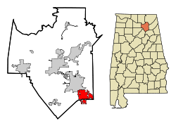
| Location in Alabama and County | |
| Basic data | |
| Foundation : | 1878 |
| State : | United States |
| State : | Alabama |
| Counties : |
Etowah County Marshall County |
| Coordinates : | 34 ° 12 ′ N , 86 ° 10 ′ W |
| Time zone : | Central ( UTC − 6 / −5 ) |
| Residents : | 9,569 (as of 2011) |
| Population density : | 302.8 inhabitants per km 2 |
| Area : | 31.7 km 2 (approx. 12 mi 2 ) of which 31.6 km 2 (approx. 12 mi 2 ) is land |
| Height : | 332 m |
| Postcodes : | 35956, 35957 |
| Area code : | +1 256 |
| FIPS : | 01-07912 |
| GNIS ID : | 0114631 |
| Website : | www.cityofboaz.org |
| Mayor : | Tim Walker |
 Thomas A. Snellgrove Homestead (2017) |
|
Boaz is a city in Etowah and Marshall Counties in the state of Alabama in the United States .
geography
Boaz is located in northeast Alabama in the southern United States. It is located about 17 kilometers south of the 28,000 ha large Guntersville Lake .
Nearby places include Albertville (immediately adjacent to the north), Sardis City (immediately adjacent to the south), Douglas (9 km to the west), Crossville (11 km to the northeast) and Walnut Grove (11 km to the southwest). The next larger city with 212,000 inhabitants is about 80 kilometers southwest of Birmingham .
history
The area around Boaz was already populated in the early 1850s, but the city was not founded until 1878. In 1886 the city was named after the Old Testament figure Boaz , and a post office was opened at the same time. In 1892 a railway line was built through the city.
For a long time, the urban economy depended on cotton production and supplies to surrounding farms. After the Great Depression , many farmers turned to poultry and cattle breeding. After the Second World War , Boaz became a center of the used car trade and in the 1970s the city received one of the first factory outlet centers in Alabama. In 2006 a new public library opened.
Four structures and sites in Boaz are listed on the National Register of Historic Places as of November 22, 2019, including the Julia Street Memorial United Methodist Church and the Thomas A. Snellgrove Homestead .
traffic
US Highway 431 and Alabama State Route 1 run on the same route from north to south of the city, both of which connect to US Highway 11 and the parallel Interstate 59 in the south . In parallel, Alabama State Route 205 runs through the city, in the city center both routes are crossed by Alabama State Route 168 .
About 5 kilometers west of the city is the Albertville Regional Airport , 21 kilometers south also the Northeast Alabama Regional Airport .
Demographics
The 2000 census showed a population of 7,411, spread over 3,155 households and 2,085 families. The population density was 235 people per square kilometer. 93.5% of the population were white, 1.3% black, 0.5% Indian and 0.5% Asian. 3.1% came from another race , 1.2% had two or more races, 4.9% were Hispanics or Latin Americans of any ethnicity . For every 100 women there were 84 men. The median age was 39 years and the per capita income was 15,664 US dollars, which put about 18.7% of the population below the poverty line.
By the 2010 census , the population had risen to 9,551.
Personalities
- Rose Maddox (1925-1998), country singer
Web links
- Official website (English).
- Statistical data on Boaz (Engl.)
- Boaz in the Encyclopedia of Alabama (Engl.)
Individual evidence
-
↑ Search mask database in the National Register Information System. National Park Service , accessed November 22, 2019.
Weekly List on the National Register Information System. National Park Service , accessed November 22, 2019.
