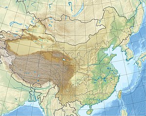
Bohai Bay
| Bohai Bay | ||
|---|---|---|
| Waters | Yellow Sea | |
| Land mass | Asia | |
| Geographical location | 38 ° 42 ′ 0 ″ N , 118 ° 6 ′ 0 ″ E | |
|
|
||
|
Bohai Bay (Bohai Wan), Laizhou Bay (Laizhou Wan) and Liaoding Bay (Liaoding Wan) in the Bohai Sea (Bo Hai) |
||
The Bohai Bay ( Chinese 渤海灣 / 渤海湾 , Pinyin Bóhǎi Wān , English Bohai Bay ) is next to the Laizhou Bay (Gulf of Laitschou) and the Liaodong Bay (Gulf of Liaodong) one of the three large sea bays / gulfs that form the Gulf of Bohai / Bohai Sea in the north of the Yellow Sea .
The Gulf of Bohai is connected to the Yellow Sea by the Bohai Strait (Chili Strait) . The bay is located to the west of the Bohai Sea and borders the area of Hebei Province and the government-direct city of Tianjin . This port city has about 14 million inhabitants. It is bounded in the north by the mouth of the Daqing He ( 大 清河 ) in the south of Laoting County ( Tangshan ) and in the south by the mouth of the Yellow River (Huang He) in Shandong. The Hai He River and the Ji Canal also flow into the bay. The average depth is about 12.5 meters, in winter it is icy for about three months (see also Beijing # climate ).
The fishery is considered to be economically important. Changlu Yanqu ( 长芦 盐 区 - "Changlu Salt District") is the most important salt production area in China. There are several oil fields in Bohai Bay ; they are operated by the China National Offshore Oil Corporation and ConocoPhillips China. The ocean- going port of Tianjin Xingang at the mouth of the Hai He in Tanggu is a large ocean-going port . The bay lies in a seismically very active zone.
Tunnel project
China was planning (as of January 2014) the construction of a 123-kilometer rail link that was to cross under the Bohai Strait . It should connect the port cities of Dalian and Yantai with each other. Dalian is known as China's northernmost ice-free seaport. The route would be longer than the two longest tunnels in the world to date: Seikan Tunnel in Japan (54 kilometers, including 23.3 km under the sea) and Eurotunnel under the English Channel (50 kilometers, including 38 km undersea).
The project has been presented to the National People's Congress several times since 2009 . In 2011 the idea found its way into the regional planning of Shandong Province , which the State Council had approved as the central government. The newspaper China Daily reported on February 14, 2014 the final draft could be submitted to the State Council in April.
see also: List of the longest tunnels on earth
Web links
- Port of Beihai Port of Tianjin (Xingang)
- Changlu Salt District
- Natural resources
- China Daily August 14, 2013: Plan envisions economic hub on Bohai Bay
Individual evidence
- ↑ Chinese Oil Leaks: Silent Catastrophe in Bohai Bay. In: Spiegel Online . July 13, 2011, accessed June 9, 2018 .
- ↑ http://smc.kisti.re.kr/quake/outline/otl02.html The Five Seismic Belts in China
- ↑ China Daily February 14, 2014: Plan drafted for $ 36b undersea tunnel.
- ↑ FAZ.net February 14, 2014: China is planning the longest underwater connection in the world.

