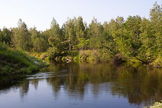
Great Kundysh
|
Big Kundysh Большой Кундыш, Bolshoi Kundysh, Кугу Кундыш |
||
| Data | ||
| Water code | RU : 08010400712112100000831 | |
| location | Kirov Oblast , Mari El ( Russia ) | |
| River system | Volga | |
| Drain over | Great Kokshaga → Volga → Caspian Sea | |
| source | 50 km north-north-west of Santschursk 57 ° 18 ′ 55 ″ N , 46 ° 53 ′ 14 ″ E |
|
| Source height | 158 m | |
| muzzle |
Great Kokschaga coordinates: 56 ° 29 ′ 21 " N , 47 ° 23 ′ 49" E 56 ° 29 ′ 21 " N , 47 ° 23 ′ 49" E |
|
| Mouth height | 75 m | |
| Height difference | 83 m | |
| Bottom slope | 0.48 ‰ | |
| length | 173 km | |
| Catchment area | 1710 km² | |
| Outflow location: 25 km above the mouth |
MQ |
5.5 m³ / s |
The Great Kundysh ( Russian Большой Кундыш, Bolshoi Kundysh ; Mari Кугу Кундыш) is a right tributary of the Great Kokshaga in Kirov Oblast and in the Republic of Mari El in the north of the European part of Russia .
The Great Kundysh rises 50 km north-north-west of Santschursk in the south-west of Kirov Oblast. The river flows through a wooded marshland east of the Wetluga in a southerly direction and flows into the Great Kokschaga after 173 km. The Great Kundysch drains an area of 1710 km². The mean discharge 25 km above the mouth is 5.5 m³ / s. The river is mainly fed by the snowmelt .
Individual evidence
- ↑ a b Great Kundysh in the State Water Register of the Russian Federation (Russian)
- ↑ a b c d Article Great Kundysch in the Great Soviet Encyclopedia (BSE) , 3rd edition 1969–1978 (Russian)
