Borsteler Binnenelbe and Großes Brack
|
Borsteler Binnenelbe and Großes Brack
|
||
|
Borsteler Inner Elbe |
||
| location | North of Buxtehude , Stade district , Lower Saxony | |
| surface | 68 ha | |
| Identifier | NSG LÜ 116 | |
| WDPA ID | 162512 | |
| FFH area | 59.6 ha | |
| Geographical location | 53 ° 33 ' N , 9 ° 43' E | |
|
|
||
| Sea level | from -1 m to 1 m | |
| Setup date | May 16, 1985 | |
| administration | NLWKN | |
The Borsteler Binnenelbe and Großes Brack is a former nature reserve in the district of Stade , Lower Saxony. It is located behind the Elbe dike on the Lower Elbe near Jork . Mudflats and marshland were under special protection here . The nature reserve designated in 1985 had the statistical designation NSG LÜ 116 of the Lower Saxony State Agency for Water Management, Coastal Protection and Nature Protection . In December 2018, the newly designated " Elbe and Islands " nature reserve opened up.
description

The approximately 68 hectare area in the northern part of the Altes Land is divided into the Borsteler Binnenelbe with the Borsteler Hafen and the Große Brack , an inland lake connected to the Inner Elbe. Significant stocks of reed beds and alluvial forest remains have been preserved in the area. For the bird world this area offers good retreat, feeding and breeding opportunities.
history
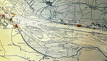
Originally the Borsteler Binnenelbe was part of the Elbe river . Upstream were Hahnöfersand and other Elbe islands with numerous shoals and sandbanks that were constantly changing and shifting. In the course of the width restriction and deepening of the Elbe river, the envelope line of today's island group was established in 1914. Shallows were removed by dredging and the dredged material was brought between and onto the islands ( Neßsand ), which were partly increased and partly connected. With the dike and damming of the Borsteler Binnenelbe for flood protection , among other things after the storm surge in 1962 , the area was separated from the Elbe.
Borsteler Inner Elbe
The Borsteler Inner Elbe runs for about four kilometers parallel to the Elbe behind the main dike and has two entrances to the Elbe protected by barriers. The nature reserve includes the water bodies of the Inner Elbe, the respective bank areas and the main dike on the former Elbe island Hahnöfersand , on which a juvenile prison and a correctional facility for women are located.
Borstel harbor
The Borsteler Hafen and its access route are in the south of the nature reserve. Here, too, only the water areas and the direct bank zones are under protection. In the port, which was decommissioned in 1970 in the course of the Elbe dike, there are some information boards on the transport of goods and fishing on the Lower Elbe, as well as on the history of the port, which played an important role in the transport of fruit from the Altes Land. The orchards of the Altes Land border the area in the south and west.
Big brack
In the east of the Inner Elbe, separated from it by Kreisstrasse 39 and the old dike ( 53 ° 32 ′ 29 ″ N , 9 ° 44 ′ 18 ″ E ), lies the inland lake Großes Brack , which has a narrow connection to the Inner Elbe. The lake created by a dike breach in the course of a storm surge is around 800 meters long.
use
The area is not accessible by roads. Entering the Elbe dike on Hahnöfersand is not possible. Some dirt roads lead through the orchard as dead ends to the banks of the Inner Elbe. The shallow water areas within the guide dams are closed to pleasure craft.
literature
- C. Buchwald, A. Mitschke (edit.): Maintenance and development plan for the NSG "Borsteler Binnenelbe and Großes Brack", BR Lüneburg. EGL, Hamburg 1995.


