Braunsel
| Braunsel | ||
|
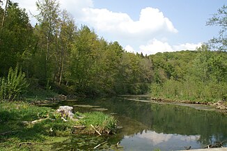
The Braunsel in the nature reserve of the same name |
||
| Data | ||
| Water code | DE : 1133934 | |
| location |
Swabian Alb
|
|
| River system | Danube | |
| Drain over | Danube → Black Sea | |
| source | east of Emeringen 48 ° 14 ′ 8 ″ N , 9 ° 31 ′ 47 ″ E |
|
| Source height | 520 m above sea level NN | |
| Spring discharge |
MQ MHQ |
400 l / s 1.5 m³ / s |
| muzzle | in front of Rechtenstein from the left and west-southwest into the upper Danube Coordinates: 48 ° 14 '23 " N , 9 ° 32' 19" E 48 ° 14 '23 " N , 9 ° 32' 19" E |
|
| Mouth height | 515 m above sea level NN | |
| Height difference | 5 m | |
| Bottom slope | 5 ‰ | |
| length | 1 km | |
| Catchment area | 5.238 km² on the surface | |
|
The Braunsel (front right) flows into the Danube |
||
The Braunsel is a left tributary of the Danube near Rechtenstein in Baden-Württemberg . With a length of just one kilometer, it is one of the shortest tributaries of the Danube.
geography
Braunsel springs
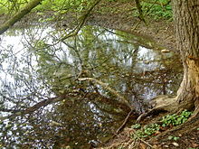
Like the Blau , Brenz and Aach, the Braunsel rises as a karst spring on the edge of the Emeringen mountain forest. The 32 springs can temporarily pour up to 1,500 liters per second (average 400 l / s). Most of the water comes from the Lauter infiltration points between Indelhausen and Lauterach . The entire catchment area of the springs probably extends further beyond the Great Lautertal .
course
The approximately 6 meters wide, clear source river flows through the nature reserve of the same name and flows into the Danube at the foot of the Hochwarthfelsen . When there is a flood, the two rivers combine to form a lake.
natural reserve
The Braunsel has been specially protected since 1991. A 40.2 hectare area in the Emeringen and Rechtenstein districts was declared a Braunsel nature reserve by the Tübingen regional council .
Web links
Individual evidence
- ^ Hans Graul : Geographical land survey: The natural space units on sheet 179 Ulm. Federal Institute for Regional Studies, Bad Godesberg 1952. → Online map (PDF; 4.8 MB)
- ↑ a b pouring according to an information board in Braunselhau.
- ↑ a b State Institute for the Environment Baden-Württemberg (LUBW) ( information )
- ↑ www.alb-donau-kreis.net (pdf) ( page no longer available , search in web archives ) Info: The link was automatically marked as defective. Please check the link according to the instructions and then remove this notice.


