Breitenfeld (Waldshut-Tiengen)
|
Breitenfeld
City of Waldshut-Tiengen
|
|
|---|---|
| Coordinates: 47 ° 39 ′ 15 ″ N , 8 ° 18 ′ 28 ″ E | |
| Height : | 493 (355-640) m |
| Residents : | 152 (2004) |
| Incorporation : | 1st January 1971 |
| Incorporated into: | Tiengen / Upper Rhine |
| Postal code : | 79761 |
| Area code : | 07741 |
Breitenfeld is a district of the district town of Waldshut-Tiengen in the district of Waldshut in Baden-Württemberg.
geography

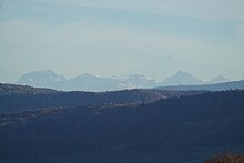
Breitenfeld lies in the Klettgau at the transition to the southern Black Forest , on the western slope of the lower Steinatal at a height of 490 m above sea level. NN . The district of Breitenfeld extends from the mountain ridge ( Hoher Brand ) in the west (approx. 640 m above sea level ) to the bottom of the valley (approx. 355 m above sea level ), but without reaching the Steina . The location of the place offers a wide view of the Klettgau to the Randen and from the Küssaburg to the Alps . In the place there is an inn, agriculture, a riding stables and a schnapps distillery. The Hasenhof is located near Breitenfeld .
history
Breitenfeld was incorporated into the neighboring town of Tiengen / Hochrhein on January 1, 1971. This merged with Waldshut on January 1st, 1975 to form the new town of Waldshut-Tiengen.
Population development
Population of Breitenfeld .
|
Economy and Infrastructure
Transport links
The 6564 district road serves as a transport link to the city of Waldshut-Tiengen , which leads to Tiengen and connects to the federal road 34 and the A98 after approx . The district road 6565 leads east into the Steinatal and connects there after approx. 1.6 km with the state road 159.
Buildings
- cath. church
- Parish hall
Individual evidence
- ^ Federal Statistical Office (ed.): Historical municipality directory for the Federal Republic of Germany. Name, border and key number changes in municipalities, counties and administrative districts from May 27, 1970 to December 31, 1982 . W. Kohlhammer, Stuttgart / Mainz 1983, ISBN 3-17-003263-1 , p. 505 and 524 .


