
Broich (Dormagen)
|
Broich
City of Dormagen
Coordinates: 51 ° 5 ′ 21 ″ N , 6 ° 43 ′ 16 ″ E
|
|
|---|---|
| Residents : | 137 (2010) |
| Incorporation : | 1st January 1975 |
| Incorporated into: | Dormagen |
| Postal code : | 41542 |
| Area code : | 02133 |
 |
|
Broich is a small village that belongs to the city of Dormagen in the Rhine district of Neuss in the state of North Rhine-Westphalia .
location
Broich is located south of the village of Gohr and borders the federal highway 477 in the west .
history

In the 18th century the place consisted of a few manors, around which a few small houses clustered. The courtyards, such as the Bergerhof and the Flexhof, consist of two-story mansions. The Flexhof has a coat of arms stone. Politically Broich belonged to the Electorate of Cologne . In 1794 the place was occupied by French troops. The place came to the Mairie Evinghoven . From 1815 Broich belonged to the Kingdom of Prussia . From 1816 he was part of the Evinghoven mayor in the Grevenbroich district . The municipality of Broich was established in 1839. In 1860 the Catholic chapel was built near Broich. In 1927 the place belonged to the district court and tax office Grevenbroich. Broich later belonged to the Evinghoven office . On April 1, 1938, the Broich community was incorporated into the Gohr community and thus became part of the Nievenheim district . Broich has been part of the city of Dormagen since January 1st, 1975 .
Residents
- 1925: 136 inhabitants
- 2010: 137 inhabitants
Attractions
Broich has a rectangular neo-Romanesque chapel with two towers. The building is made of bricks alternating with sandstone.
traffic
Federal highway 477 runs west of Broich. It goes north to Neuss and south to Rommerskirchen and further into the Eifel.
Bus transport
Broich is served by the following lines of the BVR and the StadtBus Dormagen :
- 873: Neuss - Neukirchen - Gohr - Nievenheim - Horrem - Dormagen Bf - Broich
- 874: Neuss - Gohr - Broich
- 883: Market square - Dormagen train station - Delhoven - Knechtsteden - Straberg - Nievenheim - Ückerath - Gohr - Broich
photos

chapel
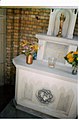
Chapel, inside

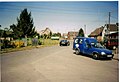
Bus stop
Village square


Individual evidence
- ^ Federal Statistical Office (ed.): Historical municipality directory for the Federal Republic of Germany. Name, border and key number changes in municipalities, counties and administrative districts from May 27, 1970 to December 31, 1982 . W. Kohlhammer, Stuttgart / Mainz 1983, ISBN 3-17-003263-1 , p. 294 .
literature
- Heinz Dohmen : City of Dormagen , Rheinische Kunststätten, issue 217, Neuss 1979.

Broich | Delhoven | Delrath | Dormagen center | Gohr | Hackenbroich | Hackhausen | Horrem | Knechtsteden | Nievenheim | Rheinfeld | City of Zons | St. Peter | Straberg | Stürzelberg | Uckerath