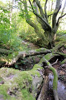
Buberlesbach
| Buberlesbach | ||
| Data | ||
| Water code | DE : 23835222 | |
| location |
Schönbuch and Glemswald
|
|
| River system | Rhine | |
| Drain over | Sommerhaldenbach → Feuerbach → Neckar → Rhine → North Sea | |
| source | in the west of the winter heap near Stuttgart- Botnang below the wild boar park 48 ° 46 '23 " N , 9 ° 6' 34" E |
|
| Source height | approx. 455 m above sea level NHN | |
| muzzle | in Botnang under Kauffmannstrasse from the right and southwest into the Sommerhaldenbach Coordinates: 48 ° 46 '44 " N , 9 ° 7' 25" E 48 ° 46 '44 " N , 9 ° 7' 25" E |
|
| Mouth height | approx. 351 m above sea level NHN | |
| Height difference | approx. 104 m | |
| Bottom slope | approx. 81 ‰ | |
| length | 1.3 km | |
| Catchment area | approx. 50 ha | |
| Reservoirs flowed through | Buberlesweiher | |
| Big cities | Stuttgart (- Botnang ) | |
The Buberlesbach is a creek a little over a kilometer long in Baden-Württemberg in the Botnang district of Stuttgart .
Origin of name
The word Buberles is derived from Buberle and that of beech. So the stream should be called Buchenbach . This is what the Botnang Chronicle reports from 1920.
geography
course
The Buberlesbach arises in the western winter dump between the wild boar park near the Saufangeiche and the outskirts of Botnang. It has two springs, the natural brook spring and the nearby artificial Buberlesbrunnen. The brook feeds the Buberlesweiher before it exits the forest and then flows through Botnang, where it finally flows under the Kauffmannstrasse into the also rotten Sommerhaldenbach , which then merges with the right Metzgerbach on the eastern edge of Botnang to form the Feuerbach .
Catchment area
From a natural spatial perspective, the catchment area belongs with its western parts to the Inner Glemswald sub-area of Schönbuch and Glemswald , the remaining part lies in the Feuerbach Bay sub-area of the Stuttgart Bay .
Buberlesweiher
A well, presumably set up in the 19th century, was destroyed by a landslide in 1968. At the beginning of the 1970s it was decided to rewrite the sources. In addition to the fountain (1970), the Kneipp facility was built in 1971 and the Buberlesweiher was also created. The artificially created, 0.2-hectare lake is located a little southwest of Botnang in the Winterhalde forest . This retention basin, created in 1970, permanently accumulates 5,000 m³ of water behind its earth dam. In addition to protecting against flooding, the Buberlesweiher is also used for nature and bird protection, for catching mud and rubble and as a fish pond.
The stream coming from the west runs through the pond and then flows through Botnang, where it feeds another, less than 0.1 hectare large pond just before the mouth.
Individual evidence
LUBW
Official online waterway map with a suitable section and the layers used here: Course and catchment area of the Buberlesbach
General introduction without default settings and layers: State Institute for the Environment Baden-Württemberg (LUBW) ( notes )
- ↑ a b Height according to the contour line image on the topographic map background layer .
- ↑ Length according to the waterway network layer ( AWGN ) .
- ↑ Catchment area measured on the background layer topographic map .
- ↑ a b Lake area according to the layer standing waters .
- ↑ Information on the retention basin after the dam layer .
Other evidence
- ^ Friedrich Huttenlocher , Hansjörg Dongus : Geographical land survey: The natural spatial units on sheet 170 Stuttgart. Federal Institute for Regional Studies, Bad Godesberg 1949, revised 1967. → Online map (PDF; 4.0 MB)
literature
- Topographic map 1: 25,000 Baden-Württemberg, as a single sheet No. 7220 Stuttgart Südwest
Web links
- Map of the course and catchment area of the Buberlesbach on: State Institute for the Environment Baden-Württemberg (LUBW) ( information )
- Map of the course and catchment area of the Buberlesbach on: Geoportal Baden-Württemberg ( information )
- Measuring table sheet 7220 Möhringen from 1899 in the Deutsche Fotothek

