Gerolstein Castle
| Gerolstein Castle | ||
|---|---|---|
|
Shield wall of the outer bailey (2012) |
||
| Alternative name (s): | Gerhardstein Castle, Löwenburg, Junkernburg | |
| Creation time : | around 1100 to 1200 | |
| Castle type : | Hilltop castle | |
| Conservation status: | Wall remains, tower remains | |
| Standing position : | Count | |
| Place: | Gerolstein | |
| Geographical location | 50 ° 13 '16.6 " N , 6 ° 40' 3.9" E | |
| Height: | 440 m above sea level NHN | |
|
|
||
The Castle Gerolstein , even Löwenburg , castle Gerhard stone or Junker Burg called, the ruins of a hilltop castle in the town of Gerolstein in the Vulkaneifel district in Rhineland-Palatinate .
location
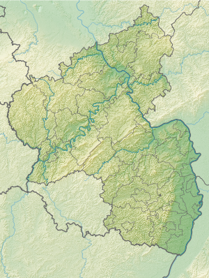
The Höhenburg is located above Gerolstein in the “An der Burg” area, next to Gerolstrasse, east of the center. The ruin is at 440 m above sea level. NHN high rock hill, covered by a rock in front of it, and rises above the valley of the Kyll , a left tributary of the Moselle and at the same time the longest river in the Eifel .
history
The Löwenburg is first mentioned in a document in 1115, when Gerhard von Blankenheim moved his seat of power to the Gerhardstein Castle he built (from which the place name of Gerolstein is probably derived). In the 13th century, Gerhard IV expanded the castle into a fortified castle with a fore and a rear castle.
After the Blankenheimers died out, Gerhardstein Castle was transferred to the Loon-Heinsberg family in 1423 and to Dietrich III, Count of Manderscheid , in 1468 . He divided his property between his three sons in 1488, with the second, Johann, inheriting the County of Blankenheim , Jünkerath , Gerolstein Castle and parts of the Mechernich rule and establishing the Manderscheid-Blankenheim-Gerolstein line.
In 1486 two chapels were added to the castle. In the 16th century, the shield wall was built with a thickness of two meters.
In 1670 the castle was badly damaged by a lightning strike in the powder tower . It was occupied by the French on July 6, 1691, but was recaptured on August 5 that same year. Gerolstein is destroyed in the process. In 1840 the castle was also known as the Jungkernburg . The remnants of the wall that remained were partially removed in the 18th century and further destroyed in the Second World War. Today there are only a few remains, but they have been restored.
investment
The formerly large castle complex with outer bailey in the north and main castle was protected by a mighty 2 meter thick shield wall 11 meters high and 35 meters long as well as two chapels from 1486, a castle chapel within a half tower and a court chapel below the rock.
literature
- Michael Losse : Theiss Castle Guide: Hohe Eifel and Ahrtahl - 57 castles and palaces . Konrad Theiss Verlag, Stuttgart 2003, ISBN 3-8062-1775-0 , pp. 66-67.
- Ernst Wackenroder (edit.): The art monuments of the Daun district. (Die Kunstdenkmäler der Rheinprovinz, 12., Düsseldorf 1928, p. 85 ff.)
Web links
- Entry on Gerhardstein Castle in the scientific database " EBIDAT " of the European Castle Institute
- Entry on Löwenburg - Gerhardstein Castle in the database of cultural assets in the Trier region .
- Gerolstein Castle at burgenwelt.de
- Reconstruction drawing


