
Calvörder Forest
As Calvörder forestry refers to the wooded area south of Calvörde , including the woodland Isernhagen between Velsdorf and Calvörde.


location
This forest is in the district of Calvörde. It stretches from Grieps (in the north) to the Schwarzen Pfuhl (in the south) near Bülstringen and from Wegenstedt (in the west) to Uthmöden (in the east). North of the Rantenhorst is the Zobbenitzer Pax , it is part of the Klüdener Pax-Wanneweh and thus the northern border of the Calvörde Forest.
Subdivision of the forest
- Schierholz
- Rantenhorst
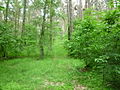
- Isernhagen
- Black pool
- Grieps
- Dorster Forest
- Portzelsgehäger
- Neuegehäge
- Altegehäge
- Claragrete
- Heron colony
- Kaisergrund
particularities
Boundary stones from the time when Calvörde belonged to the Duchy of Braunschweig can still be found in the Calvörde forest . The Klare Grete , an almost dry river, also runs along the southern border of the forest near Wieglitz . Most of the Calvörde mountains are also located in the forest and are also the southernmost and highest of the ridge, such as the Rabenberg or the Mörderberg .

Memorial stone for the almost dried up river Klare Grete

The clear Grete

Border stone in the Calvörde forest
View to the Cloridenberg

The Isernhagen lake in Calvörde


Surname
The name of the forest area changed over the centuries. When the Calvörde forest belonged to the Duchy of Braunschweig, it was called the Herzoglicher Forst Calvörde . Around 1900 the name was Staatsforst Calvörde . Today it bears the name Calvörde Forst .
literature
- Brochure of the administrative community Calvörde
- Hans-Martin Arnoldt, Kirstin Casemir, Uwe Ohainski (eds.): The Gerlach map of the Principality of Braunschweig-Wolfenbüttel (1763–1775) (= publications of the Historical Commission for Lower Saxony and Bremen 235). Hahn, Hannover 2006, ISBN 3-7752-6035-8 (folder with 18 folded multi-colored map sheets, scale 1: 42,000, and booklet).
Web links
Coordinates: 52 ° 22 '10.3 " N , 11 ° 17' 17.2" E