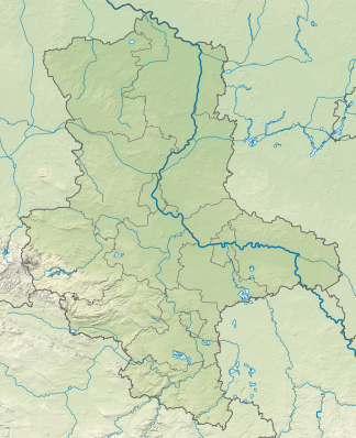
Calvör Mountains
| Calvör Mountains | ||
|---|---|---|
| Highest peak | Rabenberg ( 145.7 m above sea level ) | |
| location | Borde district , Saxony-Anhalt , Germany | |
|
|
||
| Coordinates | 52 ° 22 ′ N , 11 ° 17 ′ E | |
The Calvör Mountains are one to 145.7 m above sea level. NHN high ridge near the market town of Calvörde in the district of Börde , Saxony-Anhalt ( Germany ). They once belonged to the Calvörde Office and thus to the Free State of Braunschweig .
geography
location
The Calvörder Mountains begin in the north with the Beneberg northeast of Velsdorf . The southern elevations - such as Mörderberg , Rabenberg (highest elevation of the ridge), Mittelberg and Jacobsberg (located approximately at the southern end of the ridge) - are located in the Calvörde forest . To the west of the ridge flows the Aller tributary Spetze and south of the Bäck . The Mittelland Canal runs east to north and beyond it the Ohre .
Natural allocation
The Cloridenberg belongs in the natural spatial main unit group Weser-Aller-Flachland (No. 62), in the main unit East Brunswick Plain (624) and in the subunit Obisfelder-Calvörde terminal moraine plates (624.5) to the natural area Calvörn Hügelland (624.53).
The landscape leads to the northwest into the natural area Rätzlinger Sandplatte (624.52) and to the west into the natural area Aller-Spetze-Niederung (624.51), which belong to the same subunit, to the southwest it leads into the natural area Behlsdorfer Waldplatte (624.40) and to the south in the natural environment flange Grenzwald which the subunit (624.42) Flechtinger plate include (624.4). The natural area Calvörder Ohetal (625.01) joins in the east and the natural area Öbisfelder Talsandterrasse (625.00) in the north , which is part of the Drömling- Talsandterrassen subunit (625.0) in the Drömling main unit (625) .
Surveys
The surveys of the Calvörder Mountains include - sorted in descending order by height in meters (m) above sea level (NHN; if not otherwise specified, according to the Saxony-Anhalt viewer):
|
|
In the municipality of Calvörde are outside, but also close to the Calvör Mountains - including surveys from an unknown / not yet researched location:
|
Individual evidence
- ↑ a b c Saxony-Anhalt viewer of the State Office for Surveying and Geoinformation ( notes )
- ^ Theodor Müller : Geographische Landesaufnahme: The natural space units on sheet 87 Braunschweig. Federal Institute for Regional Studies, Bad Godesberg 1962. → Online map (PDF; 4.8 MB)
- ↑ a b c Map services of the Federal Agency for Nature Conservation ( information )
literature
- Administrative community Oebisfelde-Calvörde. 3. Edition. WEKA-Info-Verlag, Mering 2006, DNB 979226872 .
- Hans-Martin Arnholdt, Kirstin Casemir, Uwe Ohainski (eds.): The Gerlach map of the Principality of Braunschweig-Wolfenbüttel (1763–1775). Folder with 18 map sheets and booklet. (= Publications of the Historical Commission for Lower Saxony and Bremen 235 ). Self-published, Hanover 2006, ISBN 3-7752-6035-8 .
Web links
- Mieste , topographical map of the northern Calvörder mountains (Royal Prussian state image, 1900)
-
Calvörde , topographical map of the central and southern Calvörde mountains (Royal Prussian state photo, 1900;
note: the ridge is on the right-hand side of the map - running in north-north-west-south-south-east direction)

