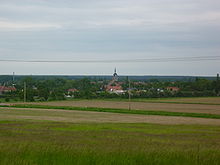
Strahlberg (Calvörde)
| Rays mountain | ||
|---|---|---|
| height | 83.4 m above sea level NHN | |
| location | near Calvörde ; Borde district , Saxony-Anhalt ( Germany ) | |
| Mountains | Calvör Mountains | |
| Coordinates | 52 ° 23 '54 " N , 11 ° 16' 15" E | |
|
|
||
The Strahlberg is 83.4 m above sea level. NHN high elevation of the Calvör Mountains . It is located in the center of the municipality of Calvörde in the Saxony-Anhalt district of Börde .
geography
location
The Strahlberg rises in the northern part of the Calvör Mountains. It lies between the villages of Calvörde in the east-south-east and Velsdorf in the north-west. To the south is the Mörderberg ( 116.8 m ), southwest of the Lange Berg ( 106 m ) and northwest of the Lauseberg ( 90.5 m ). To the north is the Isernhagen forest area . To the east the landscape slopes down to the Mittelland Canal . District road 1651 runs between the villages of Calvörde and Wegenstedt north-east of Strahlberg and state road 24 a little south of the mountain .
Natural allocation
The Strahlberg belongs to the natural spatial main unit group Weser-Aller-Flachland (No. 62), in the main unit East Brunswick Plain (624) and in the subunit Obisfelder-Calvörde terminal moraine plates (624.5) to the natural area Calvörn Hügelland (624.53).
Description and history
The Strahlberg is covered by agricultural land. The village of Isern used to be not far from the mountain and is now desolate . There was once a windmill on the mountain and to the south lies the former sand-lime brick works of Calvörde.
Individual evidence
- ↑ a b Saxony-Anhalt viewer of the State Office for Surveying and Geoinformation ( notes )
- ^ Theodor Müller : Geographische Landesaufnahme: The natural space units on sheet 87 Braunschweig. Federal Institute for Regional Studies, Bad Godesberg 1962. → Online map (PDF; 4.8 MB)
literature
- Collection of ordinances for the Herzoglich-Braunschweigische Lande, Volume 17 , on books.google.de
Web links
-
Mieste , topographical map of the Calvörder Mountains (Königlich-Prussische Landes -aufnahme, 1900); with the Strahlberg, on uni-egoswald.de;
Note: The Strahlberg is located on the southern edge of the map, southeast of Velsdorf

