Canal Vauban

The Canal de Vauban (originally Canal de Rouffach , later Canal de Neuf-Brisach ) is a former French shipping canal that was built in the Haut-Rhin department in the Alsace region and whose relics can still be seen today. It was built as Canal de Rouffach between 1698 and 1702 under the direction of the French fortress builder Vauban , by engineer Jean-Baptiste Régemortes, with the aim of getting the necessary building material for the new fortress town of Neuf-Brisach from the Vosges .
Historical background
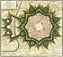
During the Thirty Years War France captured the city of Breisach in 1639 . The Peace of Rijswijk in 1697, which ended the War of the Palatinate Succession , determined the return of the areas on the right bank of the Rhine to Austria . Louis XIV was forced to re-fortify his eastern borders on the left bank of the Rhine to protect Alsace. Vauban, the king's ingenious fortress builder, was commissioned to build a new fortress in 1698 : about three kilometers west of the Rhine and exactly opposite Breisach, but out of range of his cannons. Vauban created the mighty citadel Neuf-Brisach in the form of a regular octagon, surrounded by ramparts and bastions , with triple staggered entrenchments on flat and open terrain .
Geographical course
When it was completed, the canal led from the town of Rouffach , at the transition from the Vosges to the Rhine plain , to Neuf-Brisach and flowed west of the city into the Canal de Widensolen , which carried the water northwards, where it finally came from the Blind River has been recorded. In this way, the necessary building materials, especially stone blocks from the quarries in the Vosges, but also lime and construction timber, could be transported quickly and easily to the construction site by ship. After the completion of the Neuf-Brisach Fortress, the western part of the canal was filled in again, so that its remains can only be seen between Oberhergheim and Neuf-Brisach and a water supply canal between Ensisheim and Oberhergheim. In the 19th century there was also a connection to the Rhine-Rhône Canal , which runs past the town of Neuf-Brisach to the east. In this section of the Rhine-Rhone Canal, shipping has also been closed today.
Technical characteristics
The canal had a total length of 37 kilometers, the waterway was ten meters wide and 1.50 meters deep. The canal crossed the Leek and the Ill on wooden aqueducts . He had about 15 locks , which had a dimension of 40 × 10 meters. The specially developed type of ship "Bateau de Neuf-Brisach" was used to transport the building material. This had a maximum size of 20 × 5 meters and could therefore be channeled in a "pack of four". The canal was supplied with water by discharges from the Lauch, the Vieille Thur and the Quatelbach . This artificial watercourse, which originated in the Middle Ages, was created in Mulhouse and then flowed into the Ill near Ensisheim. During the construction work, the Quatelbach was passed on to the Canal de Rouffach, which it reached at Oberhergheim. The section between Ensisheim and Oberhergheim is now also called Canal Vauban and is apparently integrated into the calculation of the length of the canal, although it never actually functioned as a navigable canal here, but only as a water inlet canal.
Economic development
Although Vauban planned a long-term economic use of the Canal de Rouffach , the section west of the Ill was filled in again in 1703 on the orders of Maréchal Catinat , commander of the Alsatian troops in the War of the Spanish Succession . The canal was then renamed Canal de Neuf-Brisach and used until around 1760. It was not until Napoleon I gave it the name Canal Vauban to honor the great fortress builder.
Web links
- Entry at structurae (German)
- Entry in the Babel project (French)
- Travel report on the relics of the canal (German)
Coordinates: 48 ° 0 ′ 44 ″ N , 7 ° 31 ′ 29 ″ E
