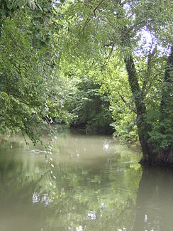
Quatelbach
| Quatelbach | ||
|
The Quatelbach |
||
| Data | ||
| Water code | FR : A1330432 | |
| location |
France
|
|
| River system | Rhine | |
| Drain over | Blind → Ill → Rhine → North Sea | |
| origin | in the urban area of Mulhouse 47 ° 45 ′ 38 " N , 7 ° 21 ′ 11" E |
|
| Source height | approx. 235 m | |
| muzzle | in the urban area of Ensisheim in the Canal Vauban Coordinates: 47 ° 51 ′ 51 ″ N , 7 ° 21 ′ 33 ″ E 47 ° 51 ′ 51 ″ N , 7 ° 21 ′ 33 ″ E |
|
| Mouth height | approx. 215 m | |
| Height difference | approx. 20 m | |
| Bottom slope | approx. 1.3 ‰ | |
| length | 15 km | |
| Big cities | Mulhouse | |
| Small towns | Sausheim , Ensisheim | |
The Quatelbach is an artificial watercourse in France , in the Haut-Rhin department , in the Grand Est region .
geography
course
The Quatelbach is branched off in the port basin of the city of Mulhouse and has been operating a number of watermills that have settled here in the Rhine valley since the Middle Ages . The stream generally flows in a northerly direction and after 15 kilometers reaches the town of Ensisheim , where it merges into the Canal Vauban .
Places on the river
history
Earlier he led at Ensisheim in the Ill , however, was in 1699 to supply water to the then Canal de Rouffach mentioned navigation canal diverted via the Vauban the building material for the construction of the fortress Neuf-Brisach from the Vosges was bring along. Since then, the water of the Quatelbach has flowed via the later so-called Canal Vauban and the Canal de Widensolen into the Blind River , which in turn flows into the Ill.
Remarks
- ↑ a b geoportail.fr (1: 16,000)
- ↑ a b The information on the length of the river is based on the information about the Quatelbach near SANDRE (French), accessed on May 10, 2011, rounded to full kilometers. The Quatelbach is wrongly called Canal Vauban here!
