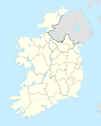
Carlow
| Carlow Ceatharlach Carlow |
||
|---|---|---|
|
|
||
| Coordinates | 52 ° 50 '10 " N , 6 ° 55' 28" W | |
| Symbols | ||
|
||
| Basic data | ||
| Country | Ireland | |
| Leinster | ||
| county | Carlow | |
| ISO 3166-2 | IE-CW | |
| height | 51 m | |
| surface | 6.5 km² | |
| Residents | 14,473 (2016) | |
| density | 2,243.9 Ew. / km² | |
| Telephone code | +353/59 | |
| Website | www.carlow.ie (English) | |
|
In the center of Carlow
|
||
Carlow ( Irish Ceatharlach 'Four Lakes' ) is a city in the southeast of the Republic of Ireland and the administrative seat of the county of the same name . Carlow is also the county's largest city; their population was determined in the 2016 Census to be 14,473.
The city is celebrated in the Irish folk song Follow Me Up to Carlow .
location
Carlow is located in the northwest of his county on the River Barrow , which also forms the border with County Laois . From the Irish capital Dublin , Carlow is 84 km to the south-west. It is on the N9 from Dublin to Waterford ; at the same time it is on the N80 from Tullamore via Port Laoise to Enniscorthy , with a connection on the N11 to Wexford and on to Rosslare Harbor .
religion
Carlow is the seat of the Roman Catholic diocese of Kildare and Leighlin . The Episcopal Cathedral of the Assumption was built from 1828 to 1833.
Town twinning
Carlow has twinned with Dole in Burgundy, France in 1982 and with Tempe, Arizona (USA) in 1998 .
Attractions
The Browneshill Dolmen (also Kernanstown Portal Tomb ) is a Neolithic portal tomb that is located about three kilometers east of Carlow.
Personalities
Honorary citizen
- Helmut Läpple (1916–2005), entrepreneur (awarded 1998)
Born in Carlow
- William Desmond Taylor (1872–1922), American film director and actor
- Patrick Walker (* 1959), soccer player and coach
- Paul Dempsey (* 1971), Roman Catholic Bishop of Achonry
- Sean O'Brien (born 1987), rugby union player


