Centelles
| Centelles municipality | ||
|---|---|---|
| coat of arms | Map of Spain | |

|
|
|
| Basic data | ||
| Autonomous Community : | Catalonia | |
| Province : | Barcelona | |
| Comarca : | Osona | |
| Coordinates | 41 ° 48 ' N , 2 ° 13' E | |
| Height : | 496 msnm | |
| Area : | 15.13 km² | |
| Residents : | 7,404 (Jan 1, 2019) | |
| Population density : | 489.36 inhabitants / km² | |
| Municipality number ( INE ): | 08067 | |
| administration | ||
| Official language : | Castilian , Catalan | |
| Mayor : | Josep Paré Aregall | |
| Website : | www.centelles.cat | |
Centelles is a Spanish municipality in the comarca of Osona in the province of Barcelona ( Catalonia ). It has 7,404 inhabitants (as of January 1, 2019) and borders the municipality of Sant Martí de Centelles in the south , Seva in the northeast and Balenyà in the northwest. It is located at the entrance to the Vic Plain , between the Congost River to the east of the parish and the mountains surrounding the Vic Plain to the west. These mountains are known as Costa and they include the Cingles (hills) del Berti and the Puigsagordi hill (972 meters) that overlooks the mountains. Centelles has good road and rail links with Vic and Barcelona . The community is a popular destination.
history
The place was first mentioned in the year 898. In the late Middle Ages the place belonged to the lords and later barons of Sant Martí, to whom the name goes back.
The place grew around the church of Santa Coloma de Pujolric, which was later called Santa Coloma de Vinyoles. In the 14th century the baron had a wall built around the city center and from then on the place was called Santa Coloma de Centelles.
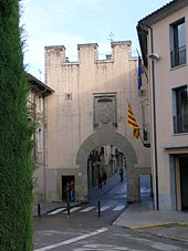
In the 15th century the barons moved their seat near the church and a century later they called themselves Barons de Centelles. The city fortifications had three gates, of which the portal nou (New Gate) is the only one that has survived .
In 1875 the Barcelona – Vic – Puigcerdà line was opened, which runs through Centelles. The station was designed by the engineer Josep Foluon i Tudó in the French style of the time.
Significant commercial and industrial development began in the still predominantly agricultural town as early as the 20th century. This took place mainly through the food and textile industries.
Since the 1960s, the place has seen a strong population increase due to the strong economy and internal migration.
population
| 1717 | 1857 | 1887 | 1900 | 1930 | 1950 | 1970 | 1981 | 1994 | 2000 | 2006 | 2008 | 2010 | 2012 | 2014 | 2016 | 2018 |
|---|---|---|---|---|---|---|---|---|---|---|---|---|---|---|---|---|
| 762 | 1.953 | 1,837 | 1,985 | 2,715 | 3.110 | 4,834 | 5,621 | 5,764 | 5,793 | 6,671 | 7.133 | 7,259 | 7,282 | 7,333 | 7,410 | 7,423 |
Attractions
- Capella de Jesús , church from the 16th century. Originally outside the city, the church is now in the city center.
- Capella dels Socors o Socós , church from the 16th century.
- El Cerdà de la Garga , birthplace of Ildefons Cerdà , a city planner.
- El Portal , city gate from 1542. The gate was renovated in 1917 and 1987.
- Molí de la Llavina
Festivals
- Festa del Pi , December 30th.
- Cau de Bruixes , January or early February.
- City festival , in August.
In 2019 there was a tragic incident at the Festa del Pi with some seriously injured.
economy
Centelles has a diverse economy, agriculture on non-irrigated land, poultry farming and industry (textiles, spinning mills, sausage factories, leather production).
sons and daughters of the town
- Ildefons Cerdà (1815–1876), civil engineer and town planner
Web links
- Official website of the City of Centelles
- Urban electricity supplier
- Description of the Festa del Pi on the Catalan edition of Wikipedia
Individual evidence
- ↑ Cifras oficiales de población resultantes de la revisión del Padrón municipal a 1 de enero . Population statistics from the Instituto Nacional de Estadística (population update).


