Cheonan
| Cheonan | |||
|---|---|---|---|
| Korean alphabet : | 천안시 | ||
| Chinese characters : | 天 安 市 | ||
| Revised Romanization : | Cheonan-si | ||
| McCune-Reischauer : | Ch'ŏnan-si | ||
| Basic data | |||
| Province : | Chungcheongnam-do | ||
| Coordinates : | 36 ° 49 ′ N , 127 ° 10 ′ E | ||
| Surface: | 636.45 km² | ||
| Residents: | 464,889 (as of 2004) | ||
| Population density : | 730 inhabitants per km² | ||
| Structure: | 5 eup, 8 myeon, 13 dong | ||
| map | |||
|
|||
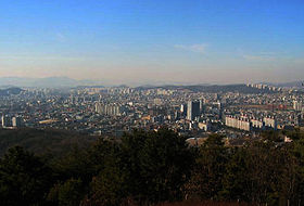
Cheonan ( kor. 천안 ) is a city in the northeast of the South Korean province of Chungcheongnam-do .
It is located around 85 km south of the capital Seoul and north of the city of Daejeon , to which it is both connected by road and train. The regular trains on the Gyeongbu Line stop at Cheonan Station , while the KTX stops at Cheonan Asan Station . Despite the distance to Seoul, the city was connected to its subway network, line 1 started operating in January 2005. Therefore, it is sometimes counted as part of the Seoul metropolitan area, Sudogwon .
To the north are the cities of Pyeongtaek and Anseong of Gyeonggi-do Province , to the east are Cheongwon and Jincheon Counties of Chungcheongbuk-do Province , to the south are Yeon-gi and Gongju Town , to the southwest to Yesan County and to the west the city of Asan .
Town twinning
-
 Beaverton , United States, since 1989
 -
 Shijiazhuang , People's Republic of China, since 1997
Web links
- Official website (English)

