Chomolhari
| Chomolhari | ||
|---|---|---|
|
Phari, steppe with Chomolhari |
||
| height | 7050 m (official height: 7326 m) | |
| location | Thimphu ( Bhutan ), Tibet (PR China) | |
| Mountains | Himalayas | |
| Dominance | 44.4 km → Pauhunri | |
| Notch height | 2086 m | |
| Coordinates | 27 ° 49 '27 " N , 89 ° 16' 12" E | |
|
|
||
| First ascent | May 1937 | |
|
View from the south from the Nyele La pass to the Chomolhari |
||
| Tibetan name |
|---|
|
Tibetan script :
ཇོ་ མོ་ ལྷ་ རི །
|
|
Wylie transliteration : jo mo lha ri
|
|
Pronunciation in IPA : [
ʨʰomoɬari ]
|
|
Official transcription of the PRCh : Qomolhari
|
|
THDL transcription : Jomolhari
|
|
Other spellings: Chomolhari, Jomolari
|
| Chinese name |
|
Simplified :
绰 莫拉 日
|
|
Pinyin : Chāomolārì
|
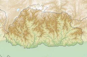
Chomolhari (also Chomo Lhari ; Tibetan ཇོ་ མོ་ ལྷ་ རི ། Wylie jo mo lha ri , "Mountain of the Goddess"), sometimes also called "Bride of Kangchenjunga ", is a mountain in the Himalayas on the border of Yadong County in the Autonomous Region Tibet Region in the People's Republic of China and Paro District in Bhutan . The mountain is on the edge of the Jigme Dorji National Park .
The mountain is sacred to Tibetan Buddhists who make a pilgrimage every year from Phari Dzong to the holy lake Chomo Lharang at about 5100 m altitude in the north of the mountain. The north face of the Chomolhari rises more than 2700 m above the barren plain at its foot.
Although the mountain is well known and offers a spectacular sight from the main trade route from India to the Tibetan Pagri Valley, very little mountaineering activity has taken place there. This was possibly due to the restricted access by the Bhutanese authorities as well as the difficulty of the routes from the Chinese side. The first ascent took place by a five-person British expedition in May 1937. Freddie Spencer Chapman and Pasang Dawa Lama reached the summit from Bhutan via the southeast spur. The second successful ascent was undertaken by an Indo-Bhutanese military expedition in 1970 led by Colonel Narendra Kumar . The third ascent was carried out in 1996 by a Japanese-Chinese expedition who reached the South Col from the Chinese side and climbed the summit via the South Ridge. In May 2004, the British mountaineers Julie-Ann Clyma and Roger Payne also reached the summit over the approximately 5800 m high south saddle after attempts to climb the impressive north-west pillar were thwarted by strong winds.
In October 2006, a six-person Slovenian team opened up two new routes, marking the fifth and sixth ascent. Rok Blagus, Tine Cuder, Samo Krmelj and Matej Kladnik took the path over the left couloir to the eastern ridge at about 7100 m on the north face , while Marko Prezelj and Boris Lorencic climbed the north-western ridge on a six-day round trip. This tour earned Prezelj and Lorencic the Piolet d'Or in January 2007.
There is no evidence that the mountain, whose official height is just over 7,300 m, was ever accurately measured. Its real altitude could be closer to 7000 m.
Web links
- Chomo Lhari, Bhutan / China on Peakbagger.com (English)
- Chomolhari at Peakware (English) with photo
- Photo of the Chomolari by Roger Payne ( September 29, 2013 memento in the Internet Archive )
Individual evidence
- ↑ Roger Payne: 2004 Chomolhari (7326m). Yadong County, Tibet. Report of the British Chomolhari Expedition April-May 2004 (PDF, 380 kB) ( Memento from September 29, 2013 in the Internet Archive )
- ^ Marko Prezelj: Chomolhari 2006. Climb And More
- ↑ Slovenians Boris Lorencic and Marko Prezelj with their Chomolhari, 7326m, Tibet, ascent via more than 1800-meter Northwest Pillar, won the 16 th Piolet d'Or. Piolet d'Or 2006 - Ascents, comments of the climbers


