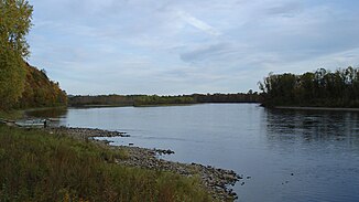
Choir (river)
|
Choir Хор, Choro, Por |
||
|
Location of the choir in the Ussuri catchment area |
||
| Data | ||
| Water code | RU : 20030700512118100061871 | |
| location | Khabarovsk region ( Russia ) | |
| River system | Amur | |
| Drain over | Ussuri → Amur → Tatar Sound | |
| source |
Sichote-Alin 48 ° 47 ′ 29 " N , 137 ° 55 ′ 52" E |
|
| Source height | approx. 940 m | |
| muzzle |
Ussuri coordinates: 47 ° 48 ′ 51 " N , 134 ° 41 ′ 9" E 47 ° 48 ′ 51 " N , 134 ° 41 ′ 9" E |
|
| Mouth height | 37 m | |
| Height difference | approx. 903 m | |
| Bottom slope | approx. 2 ‰ | |
| length | 453 km | |
| Catchment area | 24,700 km² | |
| Discharge at the gauge near the mouth |
MQ |
388 m³ / s |
| Left tributaries | Sukpai , Kafe , Katen , Matai | |
| Navigable | 196 km (limited) | |
The 453 km long choir ( Russian Хор ; also Choro or Por ) is a right tributary of the Ussuri in the Far East of Russia ( Asia ).
course
The choir rises at a height of 950 m on the western flank of the main ridge of the Sichote-Alin Mountains, a few kilometers southwest of its highest mountain, Tordoki-Jani ( 2077 m ). It flows through these mountains in a deeply cut valley in a south-westerly, later westerly direction. In the lower reaches of the river reaches the Amur lowlands , where it forms a large number of tributaries in a swampy area. Finally, the river flows about 20 kilometers west of the named after the river urban-type settlement choir and 70 kilometers southwest of Khabarovsk in the Ussuri (Chinese Wusuli Jiang ). This tributary of the Amur is already almost a kilometer wide and forms the border with the People's Republic of China . The choir is up to 300 m wide and over 3 m deep near the mouth.
Along its entire length, the choir flows on the territory of the Khabarovsk Territory .
Hydrography
The catchment area covers 24,700 km². The mean monthly water flow near the mouth is 388 m³ / s with a maximum of 5000 m³ / s. In the summer months, after heavy rainfall, catastrophic floods occasionally occur.
The choir freezes between late October / November and late April / early May.
Infrastructure and economy
The choir is navigable for smaller vehicles for 196 kilometers from the mouth.
The area on the upper reaches is practically uninhabited; the coniferous forests in the area of the middle reaches are used to a considerable extent for forestry. From here there are some villages on the river that are connected to the road network. However, there is no road along the river. The Sukpai settlement not far from the confluence of the tributary of the same name into the Chor is the end of an approximately 200-kilometer-long railway line , mainly used for forestry purposes , which branches off the Trans-Siberian Railway south of Khabarovsk . Shortly before Sukpai the route crosses the river.
The Trans-Siberian Railway itself crosses the lower reaches of the Chor not far from the largest settlement of the same name (11,441 inhabitants 2006) on the river with two bridges (the two tracks run several kilometers apart). This is also where the M60 "Ussuri" highway from Khabarovsk to Vladivostok crosses the river.


