Rivière Coaticook
|
Rivière Coaticook Coaticook River |
||
|
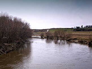
Rivière Coaticook below the Pont Drouin near Compton |
||
| Data | ||
| Water code | US : 1456932 | |
| location |
Vermont (USA), Estrie in Québec (Canada) |
|
| River system | Saint Lawrence River | |
| Drain over | Rivière Massawippi → Rivière Saint-François → Saint Lawrence River → Atlantic Ocean | |
| origin |
Norton Pond 44 ° 57 ′ 12 ″ N , 71 ° 51 ′ 1 ″ W. |
|
| Source height | 407 m | |
| muzzle |
Rivière Massawippi Coordinates: 45 ° 18 ′ 49 ″ N , 71 ° 53 ′ 55 ″ W 45 ° 18 ′ 49 ″ N , 71 ° 53 ′ 55 ″ W |
|
| Mouth height | 162 m | |
| Height difference | 245 m | |
| Bottom slope | approx. 3.5 ‰ | |
| length | approx. 70 km | |
| Catchment area | approx. 530 km² | |
| Discharge at the gauge 1.3 km below route 143 A Eo : 521 km² |
MQ 1960/2000 Mq 1960/2000 |
9.4 m³ / s 18 l / (s km²) |
| Small towns | Coaticook , Waterville | |
| Communities | Norton , Dixville , Compton | |
|
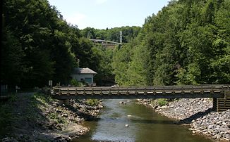
Rivière Coaticook near Coaticook |
||
The Rivière Coaticook (in the USA : Coaticook River ) is a right tributary of the Rivière Massawippi in the south of the Canadian province of Québec and in the north of the US state Vermont .
The Rivière Coaticook has its origin in the Norton Pond reservoir in Essex County (Vermont) . From there it flows 10 km northeast to Norton on the state border with Canada. It then flows through the regional county municipality of Coaticook in the administrative region of Estrie in a northerly direction. It passes Dixville , the town of Coaticook , as well as Compton and Waterville , before flowing into the Rivière Massawippi 10 km south of Sherbrooke . The river has a length of about 70 km. At the gauge near Waterville, the mean discharge is 9.4 m³ / s.
There are three small hydropower plants on the river: Eustis ( ⊙ ) with 700 kW is operated by Hydro-Sherbrooke . Belding ( ⊙ ) with 1500 kW and Saint-Paul ( ⊙ ) with 900 kW are operated by Hydro-Coaticook .
In the north of the town of Coaticook, the river flows through the deep gorge Gorge de Coaticook . A pedestrian suspension bridge spans the river valley here. The Covered Bridge Pont Drouin is located near Compton on the course of the Rivière Coaticook.
Web links
Individual evidence
- ↑ a b Water Survey of Canada: Station 02OE022 ( page no longer available , search in web archives ) Info: The link was automatically marked as defective. Please check the link according to the instructions and then remove this notice.
- ↑ Hydro-Sherbrooke: Centrale Eustis ( page no longer available , search in web archives ) Info: The link was automatically marked as defective. Please check the link according to the instructions and then remove this notice.

