Coventry (Rhode Island)
| Coventry | ||
|---|---|---|
|
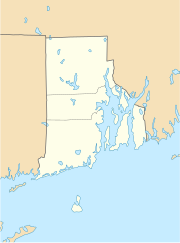
Location in Rhode Island
|
||
| Basic data | ||
| State : | United States | |
| State : | Rhode Island | |
| County : | Kent County | |
| Coordinates : | 41 ° 42 ′ N , 71 ° 36 ′ W | |
| Time zone : | Eastern ( UTC − 5 / −4 ) | |
| Residents : | 35,014 (as of 2010) | |
| Population density : | 227.1 inhabitants per km 2 | |
| Area : | 161.5 km 2 (approx. 62 mi 2 ) of which 154.2 km 2 (approx. 60 mi 2 ) is land |
|
| Height : | 129 m | |
| Postal code : | 02816 | |
| Area code : | +1 401 | |
| FIPS : | 44-18640 | |
| GNIS ID : | 1220082 | |
| Website : | www.coventryri.org | |
Coventry is a city ( town ) in Kent County , Rhode Iceland , United States . It is the city with the largest administrative area in Rhode Island.
geography
Coventry is located west of Warwick on the southwest edge of the Providence Metropolitan Area , a metropolitan area on the Atlantic coast with 1.5 million inhabitants around Providence , about 40 km southwest of Boston and 200 km northeast of New York . The city is well connected to road traffic, in addition to some state routes in and around the city, Interstate 95 runs just past it to the east.
The urban area is almost rectangular with the long side facing west-east. The dimensions are about 7.5 × 21 km, the area is 161.5 km². The Flat River , which is dammed in the Flat River Reservoir, runs through the urban area . A tributary flowing into the southwest, the Quidnick Brook, is dammed into a reservoir - the Coventry Reservoir .
The actual center of Coventry is a little closed settlement around the Flat River Reservoir . On the northeast side of the reservoir are the Coventry Schools, Coventry High School and Coventry Middle School , and Coventry Airfield. The Coventry Reservoir dam is located near the Coventry Center location on the west side of the reservoir . The city center is about 90 m above sea level. Due to the peculiarities of the administrative structure of New England, there are several villages in the urban area of Coventry, these are:
- Quidnick Village (the oldest settlement)
- Anthony Village
- Arkwright Village
- Harris Village
- Washington Village
- Coventry Center Village
- Summit Village
- Greene Village.
population
At the 2000 census , Coventry had 33,668 residents. More than 97% of them were white . The per capita income was US $ 22,091 and 5.2% of the population was below the poverty line .
history
The area was before colonization by Europeans from the Indians - master of Narragansett populated. In 1642 a group around Samuel Gorton bought an area in southern Rhode Island from the Narraganset chief Miantonomi in the so-called Shawomet Purchase . In 1647 the settlers organized an administration under the name of Warwick, in 1741 the settlers in what is now Coventry, following a successful submission to the general assembly, took the administration into their own hands.
Like many other cities and towns in Rhode Island, the settlers benefited from the abundant hydropower, so that a small industry of wool, textile and iron processing could develop in the Coventry area, which gathered around a few mills. The mills served as centers for the development of Coventry's villages. Nevertheless, the city remained largely dominated by agriculture.
The west and the center of the urban area are still rural today, but due to its proximity to the metropolitan area, the east has become a desirable residential area, with one of the highest growth rates in the entire state.
sons and daughters of the town
- Henry B. Anthony (1815–1884), politician, Governor of Rhode Island
- William Arnold Anthony (1835–1908), professor of physics and chemistry
- Warren O. Arnold (1839-2010), politician, Congressman for Rhode Island
- Henry P. Baldwin (1814–1892), politician, Governor of Michigan
Web links
Individual evidence
- ^ Coventry at GeoNames
- ^ Reflections of Coventry's Yesterdays. ( Memento of the original from March 30, 2009 in the Internet Archive ) Info: The archive link was automatically inserted and not yet checked. Please check the original and archive link according to the instructions and then remove this notice. Coventry City website
