Warwick (Rhode Island)
| Warwick | ||
|---|---|---|
|
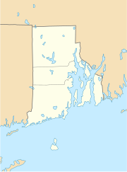
Location in Rhode Island
|
||
| Basic data | ||
| Foundation : | 1642 | |
| State : | United States | |
| State : | Rhode Island | |
| County : | Kent County | |
| Coordinates : | 41 ° 42 ′ N , 71 ° 25 ′ W | |
| Time zone : | Eastern ( UTC − 5 / −4 ) | |
| Residents : | 82,672 (as of 2010) | |
| Population density : | 899.2 inhabitants per km 2 | |
| Area : | 128.52 km 2 (approx. 50 mi 2 ) of which 91.94 km 2 (approx. 35 mi 2 ) is land |
|
| Height : | 11 m | |
| Postcodes : | 02886-02889 | |
| Area code : | +1 401 | |
| FIPS : | 44-74300 | |
| GNIS ID : | 1220018 | |
| Website : | www.warwickri.gov | |
| Mayor : | Joseph J. Solomon | |
 City Hall |
||
The city of Warwick is with 82,672 inhabitants (2010) the second largest city in the US state of Rhode Island . With the TF Green Airport, it has a centrally located airport.
Warwick is south of the city of Providence .
history
The city was founded in 1642 by Samuel Gorton . He chose the name after Robert Rich, 2nd Earl of Warwick .
In the years between 1675 and 1676 during the King Philip's War , Warwick was severely weakened. The first shot of the American independence movement was fired in Warwick : on June 9, 1772, at the British warship HMS Gaspée .
Generals Nathaniel Greene from the American independence movement and George S. Greene from the Civil War also come from Warwick .
sons and daughters of the town
- William Greene (1731–1809), politician and war in chief of the military of Rhode Island and later governor
- Ray Greene (1765-1849), US Senator
- William Daniel Brayton (1815-1887), politician
- William Sheldon (1898–1977), medical doctor and psychologist
- Walter Mossberg (* 1947), journalist, best known for his columns in the Wall Street Journal
- Lincoln Chafee (* 1953), politician and US Senator
- Ken Vandermark (* 1964), jazz saxophonist and clarinetist
- Dave Capuano (born 1968), ice hockey player
- Phillip DeVona (born 1970), actor
- Jason Hawes (* 1971), founder of TAPS
- Grant Wilson (* 1974), founder of TAPS
- Sara DeCosta (* 1977), ice hockey player and trainer
- Tom Cavanagh (1982-2011), ice hockey player
Web links
Commons : Warwick (Rhode Island) - Collection of images, videos, and audio files
- Tourist information (English)
- TF Green Airport (English)
