Dawson (Yukon)
| Dawson | ||
|---|---|---|
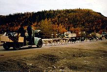
 View of Dawson and the Yukon from the Midnight Dome |
||
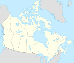
| Location in Yukon | ||
|
|
||
| State : |
|
|
| Territory : | Yukon | |
| Coordinates : | 64 ° 3 ′ N , 139 ° 25 ′ W | |
| Area : | 32.45 km² | |
| Residents : | 1375 (as of 2016) | |
| Population density : | 42.4 inhabitants / km² | |
| Time zone : | Pacific Time ( UTC − 8 ) | |
| Postal code : | Y0B 1G0 | |
| Area code : | +1 867 | |
| Foundation : | 1896 | |
| Website : | www.dawsoncity.ca | |
Dawson City or Dawson is on the right bank of the Yukon , at the mouth of the Klondike River , 150 miles south of the Arctic Circle .
Dawson is by far to Whitehorse , the second largest city in the territory of Yukon in Canada . From the foundation of the territory in 1898, Dawson was its capital until the government moved to Whitehorse, 535 km south in 1953.
history
The settlement was founded in 1896 at the start of the legendary Klondike gold rush and named after the Canadian geologist George Mercer Dawson , who explored the region.
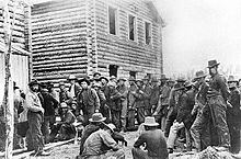
Dawson could only be reached via the White Pass or the infamous Chilkoot Trail and then via a long and arduous route by dog sled or canoe , later by paddle steamer on the Yukon. In 1898 the population had reached its peak with over 40,000 people. Belinda Mulrooney, an entrepreneur, was one of the most influential people in town at the time . It was the largest city west of Winnipeg and north of Seattle . A year later only 8,000 people lived there, in 1902 only 5,000.
Demographics
The last official census , the 2016 Census , showed a population of 1,375 inhabitants for the settlement, after the 2011 census only showed a population of 1,319 inhabitants for the municipality. Compared to the last census in 2011, the population increased by 4.2% and developed more slowly than the average for the territory, with a population increase of 5.8%. In the census period 2006 to 2011, the number of inhabitants in the municipality had decreased by 0.6%, while it increased by 11.6% on average for the territory.
At the 2016 census, the average age of the residents was 39.5 years, slightly above the territory's average of 39.1 years. The median age of the residents was determined to be 39.7 years. The median age of all residents of the territory was 39.5 years in 2016. For the 2011 census, a median age of 39.3 years was determined for the inhabitants of the municipality and 39.1 years for the inhabitants of the territory.
climate
The climate in Dawson is subarctic ( Dfc according to the Köppen and Geiger climate classification ). The average temperature in July is 15.6 ° C and in January -26.7 ° C. The highest temperature ever recorded was 34.7 ° C on May 31, 1983, while the lowest temperature was recorded on February 11, 1979 at −55.8 ° C. Temperatures below −30 ° C are very common in the winter months. The harsh and very cold winters in particular bothered the gold diggers of the founding period. All data from 2000.
| Dawson | ||||||||||||||||||||||||||||||||||||||||||||||||
|---|---|---|---|---|---|---|---|---|---|---|---|---|---|---|---|---|---|---|---|---|---|---|---|---|---|---|---|---|---|---|---|---|---|---|---|---|---|---|---|---|---|---|---|---|---|---|---|---|
| Climate diagram | ||||||||||||||||||||||||||||||||||||||||||||||||
| ||||||||||||||||||||||||||||||||||||||||||||||||
|
Climate table for Dawson City, Yukon Territory
|
||||||||||||||||||||||||||||||||||||||||||||||||||||||||||||||||||||||||||||||||||||||||||||||||||||||||||||||||||||||||||||||||||||||||||||||||||||||
Attractions
Numerous houses in the gold rush town have been restored and incorporated into a historic district, in which precise building and maintenance regulations apply. New buildings also have to be built here in the historical style.
The Dawson City Museum presents the history of the first gold mines and portrays the history of Dawson's homes. You can also see an exhibition about the railway at the turn of the century and a directory of prospectors. The fire department museum is located at the north end of the city and exhibits historic fire engines and equipment.
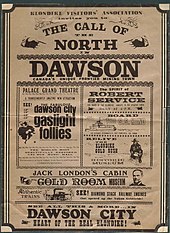
Since Dawson's gold rush found its way into world literature through writers like Jack London , the city is offering a Writers' Retreat in the childhood home of the writer Pierre Berton , which allows writers to live and work in the city for a while. The log cabin of the writer Robert William Service has been preserved, which was brought here by Jack London from Stewart Island.
In order to offer visitors the most realistic experience possible, the Free Claim # 6 was expanded as a free adventure claim on the historic Bonanza Creek. According to tradition, there is still a casino , the Diamond Tooth Gertie’s . Finally, the paddle steamer SS Keno can also be visited.
In February, the Yukon Quest , an annual dog sled race between Whitehorse and Fairbanks , stops in Dawson. It is the only place where provisions can be taken during the ten to fourteen day race.
Transport and tourism

Dawson has hotels like the Downtown Hotel and the Aurora that are open year round. About 5 minutes before Dawson, the Bonanza Gold Motel & RV Park is also available for guests all year round. Today Dawson is the destination of many canoeists who start in Whitehorse and paddle their Canadians to Dawson in 14 to 16 days . In the Hanover Zoo, some of the Dawsonian buildings have been faithfully recreated in the Yukon Bay theme park .
The Dempster Highway begins about 25 miles east of Dawson and crosses the Arctic Circle to Inuvik in the Northwest Territories. Tuktoyaktuk , located further north on the Arctic Ocean, can only be reached in winter via the Ice Road , which is laid out on the frozen Mackenzie River every December with great effort. The river will then become an important transport link for the Inuit . Because only now can larger goods transports be carried out without the aid of airplanes. However, this traffic artery is at risk due to global warming. The temperatures in 2007 were so high that the Ice Road was only passable in January - and then only with a certain risk.
In addition to the Dempster Highway with the Tombstone Territorial Park , the Top of the World Highway also offers views of wide valleys and blooming mountain ranges. The Top of the World Highway connects West Dawson, YT - Canada with Alaska, USA. The border crossing is approximately 79 miles (127 kilometers) away. The highway is usually closed in winter.
About 15 kilometers east of the community is Dawson City Airport ( IATA airport code : YDA, ICAO code : CYDA, Transport Canada Identifier: -). The airfield only has a gravel runway 1,650 meters long.
sons and daughters of the town
- Geraldine Van Bibber (* 1951), 2005–2010 Commissioner of the Yukon
- John D. Ferry (1912-2002), chemist
- Victor Jory (1902–1982), actor
Dawson City Associates
- Eskimo Welzl (1868–1948), Czech adventurer, world traveler and author, lived as a hermit in Dawson from 1930 until his death.
Web links
- Dawson City website
- map
- Dänojà Zho Cultural Center, cultural center of the Tr'ondëk Hwëch'in
- Yukon Quest website
- German website of the Yukon Quest
Individual evidence
- ^ A b Dawson Community Profile. Census 2016. In: Statistics Canada . August 9, 2019, accessed September 19, 2019 .
- ^ Dawson Community Profile. Census 2011. In: Statistics Canada . May 31, 2016, accessed September 19, 2019 .
- ↑ a b Environment and Climate Change Canada Canadian Climate Normals 1971–2000 , accessed July 9, 2010.
- ↑ wetterkontor.de
- ↑ Canadian Airports Charts. (PDF; 76.9 MB) NAV CANADA , accessed on September 19, 2019 (English).


