
Deichselbach
| Deichselbach | ||
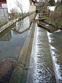
 Deichselbach in Frankendorf |
||
| Data | ||
| Water code | DE : 242912 | |
| location | Germany | |
| River system | Rhine | |
| Drain over | Regnitz → Main → Rhine → North Sea | |
| source | at Buttenheim -Tiefenhöchstadt 49 ° 51 '7 " N , 11 ° 4' 31" O |
|
| Source height | approx. 477 m above sea level NHN | |
| muzzle | near Altendorf in the Regnitz coordinates: 49 ° 47 '49 " N , 10 ° 59' 54" E 49 ° 47 '49 " N , 10 ° 59' 54" E |
|
| Mouth height | approx. 245 m above sea level NHN | |
| Height difference | approx. 232 m | |
| Bottom slope | approx. 20 ‰ | |
| length | 11.5 km | |
The Deichselbach is an 11.5 km long right and eastern tributary of the Regnitz .
geography
course
The Deichselbach rises near Buttenheim -Tiefenhöchstadt. At Altendorf it crosses under the Main-Danube Canal and then flows into the Regnitz .
Tributaries
- Schußbach ( right )
- Siebenbach ( right )
places
The Deichselbach flows through the following places:
Picture gallery

Deichselbach in Stackendorf
Deichselbach in Buttenheim


Web links
Commons : Deichselbach (Regnitz) - Collection of images, videos and audio files
Individual evidence
- ↑ Map services of the Bavarian State Office for the Environment