
Dender
| Dender | ||
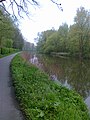
 The mouth of the Dender (foreground) into the Scheldt (background) |
||
| Data | ||
| location | Belgium : Provinces of Hainaut and East Flanders | |
| River system | Scheldt | |
| Drain over | Scheldt → North Sea | |
| source | at Ath by the confluence of the Eastern Dender and the Western Dender | |
| Source height | 65 m | |
| muzzle | at Dendermonde in the Scheldt Coordinates: 51 ° 2 '42 " N , 4 ° 5' 21" E 51 ° 2 '42 " N , 4 ° 5' 21" E
|
|
| length | 65 km | |
| Medium-sized cities | Geraardsbergen , Ninove , Aalst | |
The Dender (French Dendre ) is a river in Belgium in the catchment area of the Scheldt . Although the river flows through three provinces, namely Hainaut , East Flanders and Flemish Brabant , only the East Flanders section is named Denderstreek . Their total length is 65 km. The river is created in the Walloon municipality of Ath (at an altitude of around 65 m) by the confluence of the Eastern Dender (source on the border between Masnuy-Saint-Jean and Masnuy-Saint-Pierre ) and the Western (or Little) Dender. The Dender flows into the Scheldt at Dendermonde .
Tributaries of the Dender
- Molenbeek-Ter Erpenbeek ( Hofstade )
- Bellebeek ( Liedekerke and Denderleeuw )
- Marcq ( Lessines -Deux-Acren)
- Ruisseau d'Ancre ( Lessines )
- Sille ( Ath )
- Dendre Orientale and Dendre Occidentale ( Ath )
Web links
Commons : Dender - collection of images, videos and audio files
The Dender in Aalst and Erembodegem
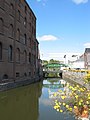
Bridge over the Dender in Lessines

.JPG)