Destel
|
Destel
Stemwede municipality
Coordinates: 52 ° 22 ′ 10 ″ N , 8 ° 29 ′ 28 ″ E
|
|
|---|---|
| Height : | 57 m above sea level NN |
| Area : | 8.36 km² |
| Residents : | 700 (1972) |
| Population density : | 84 inhabitants / km² |
| Incorporation : | 1st January 1973 |
| Postal code : | 32351 |
| Area code : | 05745 |
|
Location of Destel in Stemwede
|
|
Destel is a small town a few kilometers north of the Mittelland Canal . It belongs to the municipality of Stemwede , of which it is the southernmost part of the municipality, in the North Rhine-Westphalian district of Minden-Lübbecke .
history
In 969 Destel was first mentioned in a document.
On April 1, 1936, only about a third of the previous municipal area (8.49 km 2 ) remained near Destel. The remaining area (16.78 km 2 ) was given up to form the new municipality of Twiehausen .
After the old school was sold in 1959 and converted into apartments, the new school was inaugurated on January 15, 1960. After a short time (1973) the school was closed again as part of the school reform of the state of North Rhine-Westphalia.
On January 1, 1973 Destel was incorporated into the new municipality of Stemwede.
Attractions
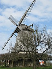
The windmill (Galerie-Holländer) from the beginning of the 19th century is worth seeing. The mill is part of the Westphalian Mill Road .
traffic
The next junction is Bünde on the A 30 .
Web links
Individual evidence
- ↑ Stephanie Reekers: The regional development of the districts and communities of Westphalia 1817-1967 . Aschendorff, Münster Westfalen 1977, ISBN 3-402-05875-8 , p. 226 .
- ^ Federal Statistical Office (ed.): Historical municipality directory for the Federal Republic of Germany. Name, border and key number changes in municipalities, counties and administrative districts from May 27, 1970 to December 31, 1982 . W. Kohlhammer, Stuttgart / Mainz 1983, ISBN 3-17-003263-1 , p. 325 .


