
Woe
|
Woe
Stemwede municipality
Coordinates: 52 ° 26 ′ 17 ″ N , 8 ° 27 ′ 54 ″ E
|
|
|---|---|
| Height : | 58 m above sea level NN |
| Area : | 12.98 km² |
| Residents : | 1830 |
| Population density : | 141 inhabitants / km² |
| Incorporation : | 1st January 1973 |
| Postal code : | 32351 |
| Area code : | 05773 |
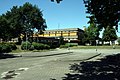
 Location of Wehdem in Stemwede
|
|
Wehdem ( Low German : Wäihme ) is a district of the municipality of Stemwede in the North Rhine-Westphalian district of Minden-Lübbecke with a closed town center on the southern slope of Stemweder Berg in the North German Plain . About 1830 people live here. The place has a secondary school, a dual gym, a kindergarten and sports facilities.
Wehdem is the winner of the competition Our village should become more beautiful .
history
Wehdem was first mentioned in a document in 969 . On January 1, 1973, the Dielingen-Wehdem office in the former Lübbecke district became part of the new municipality of Stemwede due to the Bielefeld Act .
Personalities
- Fritz Brosin (1858–1900), physician and climbing pioneer
- Gustav Niermann (1919–1989), farmer and CDU politician
traffic
The next junctions are Melle-Ost and Kirchlengern on the A 30 and the transition to the B 51 / B 65 on the A 33 .

The Wehdemer Church
Wehdem school center
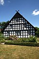
Home house in Wehdem


Individual evidence
- ^ Federal Statistical Office (ed.): Historical municipality directory for the Federal Republic of Germany. Name, border and key number changes in municipalities, counties and administrative districts from May 27, 1970 to December 31, 1982 . W. Kohlhammer, Stuttgart / Mainz 1983, ISBN 3-17-003263-1 , p. 325 .
Web links
- Historical postcards from Wehdem
- Woe to in the Westphalia culture atlas
