
Butha-Buthe District
| map | |
|---|---|
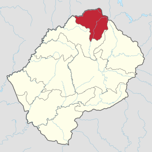  Location of the Butha-Buthe district in Lesotho |
|
| Basic data | |
| Administrative city | Butha-buthe |
| surface | 1767 km² |
| population | 118,242 (as of 2016) |
| Population density | 67 inhabitants / km² |
| ISO 3166-2 |
LS-B
|
| Telephone code | +266 |
The district Butha-Buthe , also Botha-Bothe , is one of the ten districts (districts) of the Kingdom of Lesotho in southern Africa .
geography
The district of Butha-Buthe is the northernmost and with 1767 km² the smallest of the ten districts of Lesotho. In 2016 it had 118,242 inhabitants. It stretches from the main town of the same name, Butha-Buthe, in the west, to the 3240-meter-high Khaleng-la-Lithunya (German: "Pass of the Guns") in the east. In the south, the district extends in the valley of the Malibamatšo to close to the Katse reservoir , and in the north to the 2028 meter high Mafika Lisiu pass, the border crossing to the former South African homeland QwaQwa . This means that the district is partly in the densely populated Lowlands , partly in the Maloti Mountains .
The most important pass is the Moteng Pass, which has to be crossed on the way from Butha-Buthe east to the Maloti Mountains.
Adjacent districts are Leribe in the south and west and Mokhotlong in the east and the South African province of Free State in the north.
Localities
- Butha-buthe
- Khukhune
- Qalo
- Muela, with power station and catch basin
- Ha Seboche, located in the Maloti Mountains, with a hospital
- Oxbow with Afri-Ski , the only ski area in southern Africa
Community Councils
The community councils are Kao, Likila, Linakeng, Lipelaneng, Liqhobong, Makhunoane, 'Moteng, Ntelle, Sekhobe and Tša-Le-Moleka.
Web links
Individual evidence
- ↑ 2016 Summary Key Findings. Bureau of Statistics (PDF), accessed March 17, 2018
- ↑ Statistics at statoids.com (English), accessed on December 28, 2012
Berea | Butha-Buthe | Leribe | Mafeteng | Maseru | Mohale's Hoek | Mokhotlong | Qacha's Nek | Quthing | Thaba-Tseka
Coordinates: 28 ° 50 ′ S , 28 ° 30 ′ E