
Mafeteng District
| map | |
|---|---|
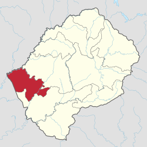  Location of the Mafeteng district in Lesotho |
|
| Basic data | |
| Administrative city | Mafeteng |
| surface | 2119 km² |
| population | 178,222 (as of 2016) |
| Population density | 84 inhabitants / km² |
| ISO 3166-2 |
LS-E
|
| Telephone code | +266 |
The Mafeteng District is one of ten districts (districts) of the Kingdom of Lesotho in southern Africa .
geography
The district is located southwest of the central Maseru district . It is named after its capital Mafeteng .
Its size is 2119 km², its population 178,222 (as of 2016).
See also: Data from the districts of Lesotho
Unlike the rest of the country's districts, the Mafeteng district is located exclusively in the Lowlands and is therefore the district with the lowest maximum altitude. This explains the high population density, as the Lowlands in Lesotho are much more densely populated. In the west of the Mafeteng district you will find the lowest area of the country, but at around 1390 meters above sea level, it is higher than in any other country on earth.
The district borders in the north and east on the district Maseru and in the south on Mohale's Hoek . West of the Mafeteng district is the South African province of Free State , to which there is a border crossing at Wepener .
Localities
- Mafeteng
- Thabana-Morena
- Tša-Kholo, German: Large lake , west of Mafeteng, named after the largest lake in Lesotho on which the place is located
- Malealea, southeast of Mafeteng, with tourist infrastructure, known for its panorama of the high Maloti mountains
- Ha Khojane, there has been a printing company there since 1904, which publishes the newspaper Naleli ea Lesotho (German roughly: "Star of Lesotho")
Community Councils
The community councils are Koti-Se-Phola, Makaota, 'Makholane,' Malakeng, Malumeng, 'Mamantšo, Monyake, Mathula, Metsi-Maholo, Qibing, Ramoetsane and Tajane.
literature
- David Ambrose : The Guide to Lesotho. 2nd Edition. Winchester Press, Johannesburg / Maseru 1976, ISBN 0-620-02190-X .
Web links
Individual evidence
- ↑ 2016 Summary Key Findings. Bureau of Statistics (PDF), accessed March 17, 2018
- ↑ Statistics at statoids.com (English), accessed on December 29, 2012
Berea | Butha-Buthe | Leribe | Mafeteng | Maseru | Mohale's Hoek | Mokhotlong | Qacha's Nek | Quthing | Thaba-Tseka
Coordinates: 29 ° 50 ′ S , 27 ° 55 ′ E