
Maseru District
| map | |
|---|---|
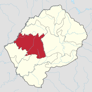  Location of the Maseru district in Lesotho |
|
| Basic data | |
| Administrative city | Maseru |
| surface | 4279 km² |
| population | 519,186 (as of 2016) |
| Population density | 121 inhabitants / km² |
| ISO 3166-2 |
LS-A
|
| Telephone code | +266 |
The Maseru district is the most populous administrative unit within Lesotho , located in southern Africa . Around a quarter of the country's population lives there.
geography
The Maseru district is located in western Lesotho. It covers an area of 4279 km². In 2016, 519,186 residents lived there. Maseru is the Lesotho district with the highest population density.
From north to south, clockwise, the Maseru district borders the Berea , Thaba-Tseka , Mohale's Hoek, and Mafeteng districts . In the west, the Caledon River ( Sesotho : mohokare ) forms the border with the South African province of Free State .
While the district in the west contains large parts of the densely populated Lesothic Lowlands , the eastern part of the district is in the Highlands or Maloti Mountains , often inaccessible mountain regions. The lowest altitude is about 1,400 meters in the southwest of the district. The highest mountain in the district is the 2,886 meter high Machache, which is the most prominent part of the Front Range , the westernmost mountain range in the Highlands.
Localities
Maseru

Maseru is the capital of Lesotho. The city is by far the most populous in the country and the economic center of Lesotho. Maseru is also the seat of the district administration.
Roma
The National University of Lesotho, the only university in Lesotho , is located in Roma, 35 kilometers southeast of Maseru . In addition, the place is the nucleus of the Roman Catholic Church in today's Lesotho.
Morija
Morija is about 40 kilometers south of Maseru. The first mission under Moshoeshoe I was founded here in 1833 by French missionaries . To this day, Morija is the center of the Lesotho Evangelical Church . The Morija Arts & Cultural Festival takes place here every year. The place is named after the biblical place Moriah - today: Jerusalem Temple Mount - where Abraham was supposed to sacrifice his son Isaac .
Thaba Bosiu

Thaba Bosiu (German roughly: mountain by night) is about 20 kilometers east of Maseru. The place was from 1824 to 1870 the seat of the chief Moshoeshoe I. In 1837 the second mission station of the country was founded there. On the plateau above the town there was security from onrushing troops - this plateau could never be captured, so that the Basotho nation could never be subjugated by hostile powers. The place is still venerated as a national shrine today.
Matsieng
Rural Matsieng east of Morija is the seat of the royal dynasty. There are some exemplary agricultural projects here and generally a good infrastructure. It was founded in 1858 by Letsie I , a son of Moshoeshoe I. The name means "The place of Letsie's people".
Mazenod
Mazenod is about 16 kilometers south of Maseru on the main road. Since 1930 it has been the seat of a printing company owned by the Roman Catholic Church in Lesotho . The weekly Moeletsi oa Basotho has been published there ever since . Moshoeshoe I. International Airport is nearby .
Ha Khotso
The most famous cave drawings in Lesotho can be found near the village of Ha Khotso north of Roma . The place is called Ha Baroana (German: the little San ). The drawings are probably a few hundred years old. In an overhanging wall you can find numerous artistic representations of the hunting prey such as wildebeest and other antelopes .
Semonkong

The most important place in the Maseru district in the Highlands is Semonkong with 7856 inhabitants (as of 2016). Tourist accommodation can be found in the village, as the Maletsunyane waterfall is nearby , with a height of around 192 meters, the highest single-tier waterfall in southern Africa. Semonkong itself is about 2200 meters above sea level.
Community Councils
The Community Councils are Abia, Likalaneng, Lilala, Lithabaneng, Lithoteng, Makheka, Makhoarane, Makhalaneng, Makolopetsane, Manonyane, Maseru Central, Mazenod, Mohlakeng, Motimposo, Nyakosoba, Qiloane, Qoaling, Ratau, Ribaneng, Semonk Stadium Area and Telle.
literature
- David Ambrose : The Guide to Lesotho. 2nd Edition. Winchester Press, Johannesburg / Maseru 1976, ISBN 0-620-02190-X .
Web links
Individual evidence
- ↑ Lesotho: Districts & Cities - Population Statistics, Maps, Charts, Weather and Web Information. Retrieved March 17, 2018 .
- ↑ a b 2016 Summary Key Findings. Bureau of Statistics (PDF), accessed March 17, 2018
- ↑ Statistics at statoids.com (English), accessed on December 29, 2012
Coordinates: 29 ° 30 ′ S , 28 ° 0 ′ E
Berea | Butha-Buthe | Leribe | Mafeteng | Maseru | Mohale's Hoek | Mokhotlong | Qacha's Nek | Quthing | Thaba-Tseka