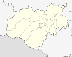
Dygulybgei
| Village
Dygulybgei
Дыгулыбгей
|
||||||||||||||||||||||||||||
|
||||||||||||||||||||||||||||
|
||||||||||||||||||||||||||||
| List of large settlements in Russia | ||||||||||||||||||||||||||||
Dygulybgei ( Russian Дыгулыбге́й ) is a village (selo) in the Republic of Kabardino-Balkaria in Russia with 20,228 inhabitants (as of October 14, 2010).
geography
The place is about 20 km as the crow flies north-northwest of the republic capital Nalchik on the northern edge of the Greater Caucasus on the right bank of the Baksan River .
Dygulybgei belongs to the Baksan district and is located about 2 km south of the center of Baksan , across the river, in fact, directly adjacent to the city.
history
Until around 1990 the village was called Kysburun 3-j (also Kysburun Treti ), meaning “Third Kysburun” as opposed to the “First” and “Second Kysburun” ( Kysburun 1-j, since 2004 Ataschukino again upstream on the Baksan) , and Kysburun 2-j, since 1992 Islamei again ). Already as Dugulubgei the place was incorporated into Baksan in 2003, but a few years later it was spun off again under the current name, but remained in the urban district.
Population development
| year | Residents |
|---|---|
| 1939 | 5,179 |
| 1970 | 8,898 |
| 1979 | 11,020 |
| 2002 | 20,355 |
| 2010 | 20,228 |
Note: census data
traffic
The old route of the federal highway R217 Kawkas (formerly M29), which runs along the northern edge of the Caucasus to the Azerbaijani border, runs through Dugulubgei . A motorway-like bypass road has existed there since the 1970s and leads past the village and the neighboring town of Baksan to the southwest.
Individual evidence
- ↑ a b Itogi Vserossijskoj perepisi naselenija 2010 goda. Tom 1. Čislennostʹ i razmeščenie naselenija (Results of the All-Russian Census 2010. Volume 1. Number and distribution of the population). Tables 5 , pp. 12-209; 11 , pp. 312–979 (download from the website of the Federal Service for State Statistics of the Russian Federation)

