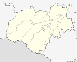
Islamei
Village
|
||||||||||||||||||||||||||||||||
|
||||||||||||||||||||||||||||||||
|
||||||||||||||||||||||||||||||||
| List of large settlements in Russia | ||||||||||||||||||||||||||||||||
Islamei ( Russian Исламей ; Kabardian Ислъамей ) is a village (selo) in the Republic of Kabardino-Balkaria in Russia with 11,261 inhabitants (14 October 2010).
geography

The place is located on the northern edge of the Greater Caucasus a good 20 km as the crow flies north-northwest of the republic capital Nalchik , on the left bank of the Baksan .
Islamei belongs to Rajon Baksanski and is located approximately 6 km west of the administrative center of Baksan . The village is the seat and only locality of the rural community (selskoje posselenije) Islamei.
history
The village was first named in 1640 under the current Kabardian name, Islamowo in the Russian form , derived from the first name of the son of a Kabardian prince, Islam Atashukov. From 1732 it was named Naurusowo (Kabardian Naurysei ) after his son Naurus , later also the names of other members of the royal family, Kartula (1773–1787) and Bekmursa (after 1840). During the Caucasus War from 1817 to 1864 , the village was largely abandoned by the Cabardinine ( Circassian ) population from 1825 to the 1840s .
In the 1850s in the area, several new emerged Aule , which in 1867 officially back under the name Naurusowo were united in the russi ed form. After the October Revolution , this was abolished in 1920, as in many other Kabardian places, as a derivation from the name of a noble family and the new name Kysburun 2-j ( Kysburun Wtoroi , "Second Kysburun") was given, in the approximate meaning of "girl's rock", but in Karachay-Balkar , according to a local legend; the south-west adjoining Ataschukino became Kysburun 1-j and the east-lying Dygulybgei Kysburun 3-j, correspondingly "first" and "third Kysburun". Since 1992 the village has had its original name again.
Population development
| year | Residents |
|---|---|
| 1939 | 5,327 |
| 1970 | 7,325 |
| 1979 | 9,156 |
| 2002 | 10,582 |
| 2010 | 11,261 |
Note: census data
traffic
South-east of the village, on the opposite bank of the Baksan, runs the new route of the federal trunk road A158 , which , coming from Prochladny between the city of Baksan, Dygulybgei and Islamei, crosses the R217 Kawkas (there as a bypass of Baksan) and continues up the Baksan river via Tyrnyaus leads to Terskol below the Elbrus . The old route of the A158 leads through Islamei.
The nearest train station is in Nalchik.
Web links
- Official website of the local government (Russian)
Individual evidence
- ↑ a b Itogi Vserossijskoj perepisi naselenija 2010 goda. Tom 1. Čislennostʹ i razmeščenie naselenija (Results of the All-Russian Census 2010. Volume 1. Number and distribution of the population). Tables 5 , pp. 12-209; 11 , pp. 312–979 (download from the website of the Federal Service for State Statistics of the Russian Federation)
- ↑ Islamei ( memento of the original from June 8, 2013 on WebCite ) Info: The archive link was automatically inserted and not yet checked. Please check the original and archive link according to the instructions and then remove this notice. on the Rajon's website (Russian)

