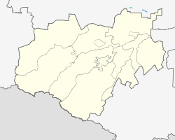
Baksan (city)
city
|
||||||||||||||||||||||||||||||||||||||||
|
||||||||||||||||||||||||||||||||||||||||
|
||||||||||||||||||||||||||||||||||||||||
| List of cities in Russia | ||||||||||||||||||||||||||||||||||||||||
Baksan ( Russian Бакса́н ) is a city in the North Caucasian Republic of Kabardino-Balkaria with 36,860 inhabitants (as of October 14, 2010).
geography
The city is located on the northern edge of the Greater Caucasus about 25 km northwest of the republic capital Nalschik on the Baksan , a right tributary of the Malka, which flows into the Terek .
Baksan forms an independent urban district and is also the administrative center of the Rajon of the same name .
The city is located on the M29 Rostov-on-Don - Azerbaijani border road, which is developed like a motorway here and is a bypass road to the southwest around the city.
history
A village in the place of today's city was first mentioned in a document in 1748. In 1822, a fortified settlement was built as part of the Caucasus Defense Line on what was then the southern border of the Russian Empire. Another settlement was established in 1891 by resettlers from central Russia and Ukraine .
Gradually these settlements grew together; 1960 Staraja Krepost (or Kabardian Kutschmasukino after Kabardinian Prince sex Kuschmasoko ) connected. In 1964 the place received the status of an urban-type settlement and in 1967 the town charter .
In 2003 the large village of Dugulubgei (formerly Kysburun 3-j / Kysburun Treti ) , located directly opposite on the right bank of the Baksan, was incorporated, so that the number of inhabitants rose sharply compared to the last census in 2002. A few years later, however, the village became independent again under the modified name of Dygulybgei within the Baksan district.
Population development
| year | Residents | annotation |
|---|---|---|
| 1939 | 3,805 | Kysburun Treti 5,197 |
| 1959 | 3,583 | Staraja Krepost 8.018 |
| 1970 | 18,443 | Kysburun Treti 8,898 |
| 1979 | 21,843 | Kysburun Treti 11,020 |
| 1989 | 28,800 | |
| 2002 | 35,805 | Dugulubgei 20,355 |
| 2010 | 36,860 | Dygulybgei 20,228 |
Note: census data
economy
Baksan has radio electronics and vehicle spare parts plants as well as the textile and food industries.
The Baksan hydroelectric power station is located above the city on the Baksan River .
Web links
- Baksan on mojgorod.ru (Russian)
Individual evidence
- ↑ a b Itogi Vserossijskoj perepisi naselenija 2010 goda. Tom 1. Čislennostʹ i razmeščenie naselenija (Results of the All-Russian Census 2010. Volume 1. Number and distribution of the population). Tables 5 , pp. 12-209; 11 , pp. 312–979 (download from the website of the Federal Service for State Statistics of the Russian Federation)


