Salukoko ash
Urban-type settlement
|
||||||||||||||||||||||||||||||||
|
||||||||||||||||||||||||||||||||
|
||||||||||||||||||||||||||||||||
Salukokoasche ( Russian Залукокоаже , Kabardian Дзэлыкъуэ къуажэ ) is an urban-type settlement in the Republic of Kabardino-Balkaria ( Russia ) with 9,859 inhabitants (as of October 14, 2010).
geography
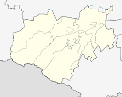
The settlement is located on the northern edge of the Greater Caucasus a good 50 km as the crow flies northwest of the republic capital Nalchik, not far from the border with the Stavropol region , about 20 km from the city of Pyatigorsk , on the upper reaches of the Solka , a right tributary of the Kuma .
Salukokoasche is the administrative center of Solski Rajons , which occupies the north-western part of the republic. Most of the inhabitants of the Rajon as well as the settlement are Kabardines .
history
The place was founded in 1904 by Kabardian resettlers from the Aul Abukokuasche (Russian Abukowo ) near Kislowodsk (today Perwomaiskoje) and initially had the same name.
1913 in the area to unrest among the Cabardine small farmers, which was directed against a land grab sanctioned by the authorities by Cabardine stud owners and Cossacks and was later referred to as the Solka uprising . Among other things, the later party functionary of the Bolsheviks Sergei Kirov , who was staying in the North Caucasus during this time, and for whom a memorial was erected in the village during the Soviet period, was involved.
On May 14, 1920 the place received its current name, a transformation of the Cabardian words dsel ( 'pasture' ), kue ('valley') and kuasche ('settlement'); the name therefore stands for a "settlement in a river valley overgrown with willows".
During World War II Salukokoasche was occupied by the German Wehrmacht from August 2, 1942 to January 11, 1943 .
Salukokoasche has had the status of an urban-type settlement since 1976.
Population development
| year | Residents |
|---|---|
| 1959 | 2,567 |
| 1970 | 3,636 |
| 1979 | 4,364 |
| 1989 | 6.110 |
| 2002 | 9,276 |
| 2010 | 9,859 |
Note: census data
Economy and Infrastructure
Salukoko ash is located in an agricultural area in which primarily fruit, vegetables and wheat are grown and cattle is raised.
The M29 trunk road (on this section also European route 117 ) on the section between Pyatigorsk (where the next train station is) and Baksan runs along the northern edge of the Caucasus towards Azerbaijan .
Individual evidence
- ↑ a b Itogi Vserossijskoj perepisi naselenija 2010 goda. Tom 1. Čislennostʹ i razmeščenie naselenija (Results of the All-Russian Census 2010. Volume 1. Number and distribution of the population). Tables 5 , pp. 12-209; 11 , pp. 312–979 (download from the website of the Federal Service for State Statistics of the Russian Federation)
- ↑ Ethnic composition of Kabardino-Balkaria 1897–2002 (Russian)
- ↑ Rajons Solski ( page no longer available , search in web archives ) Info: The link was automatically marked as defective. Please check the link according to the instructions and then remove this notice. in the web portal of the government of Kabardino-Balkaria (Russian)
- ↑ Salukokoasche on the website of the Geographical Institute of the RAN (Russian)

