Ansorei
Village
|
||||||||||||||||||||||||||||||||
|
||||||||||||||||||||||||||||||||
|
||||||||||||||||||||||||||||||||
Ansorei ( Russian Анзоре́й , Kabardian Андзорей ) is a village (selo) in the Republic of Kabardino-Balkaria ( Russia ) with 6551 inhabitants (as of October 14, 2010).
geography
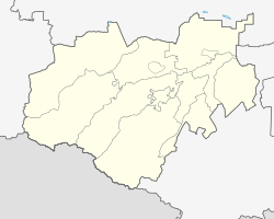
The place is located on the northern edge of the Greater Caucasus a good 30 km as the crow flies southeast of the republic capital Nalschik not far from the border with the Republic of North Ossetia-Alania . It is located on the right bank of the Lesken River when it reaches the plain that gradually descends to the Terek , into which it flows almost 20 km northeast from the left. The village of Lesken Wtoroi is located on the left bank of the river across from Ansorei .
Ansorei administrative center is the Rajons Leskenski and seat and only town in the rural community Selskoje posselenije Ansorei. The inhabitants of the Rajons as well as the village are almost exclusively Kabardines .
history
The place arose at the latest at the beginning of the 16th century and was named after a Kabardian dynasty residing in this area with the Russified name form Andsorow. From 1860 he belonged to the Okrug Nalchik of the Terek Oblast ; the official Russian name was Ansorowo, until the village was renamed Stary Lesken ("Old Lesken") in 1920 in the course of the abolition of "Kabardian feudal designations" by the Soviet authorities .
Within the Kabardian Autonomous Oblast formed on September 1, 1921 (from January 16, 1922 Kabardino-Balkarian Autonomous Oblast), the village belonged to the Urwanski okrug (from September 30, 1931 Rajon) with its seat in Stary Tscherek, just under 15 km north-west . After the formation of the Kabardino-Balkarian ASSR on December 5, 1936, the Leskenski rajon, named after the river and based in Stary Lesken, was spun off on December 29, 1937.
During the Second World War , Stary Lesken was occupied by the German Wehrmacht from October 26, 1942 to January 3, 1943 .
On December 20, 1962, the Rajon was dissolved and its territory was re-incorporated into the Urwanski rajon. In 1993 the village was given its old name again, in the Russified form Ansorei, which is now closer to the Kabardian-Circassian . On August 8, 2003, the Rajon, which was dissolved in 1962, was also restored.
Population development
| year | Residents |
|---|---|
| 1939 | 3371 |
| 1959 | 4198 |
| 2002 | 6931 |
| 2010 | 6551 |
Note: census data
traffic
On the northern edge of the place runs along the northern edge of the Caucasus from Pavlovskaya in the Krasnodar region to the state border with Azerbaijan, the R217 Kawkas highway (on this section also European route 117 ). A little to the west branches off the regional road, which initially follows the river Lesken up through Lesken Wtoroi and then leads in North Ossetia-Alania as 90K-001 via Tschikola , Digora and Ardon to Vladikavkaz .
The nearest train station is about 30 km away in Nartkala ( Dokschukino station ) on the route from Maiski ( Kotlyarevskaya station ) to Nalchik.
Web links
Individual evidence
- ↑ a b Itogi Vserossijskoj perepisi naselenija 2010 goda. Tom 1. Čislennostʹ i razmeščenie naselenija (Results of the All-Russian Census 2010. Volume 1. Number and distribution of the population). Tables 5 , pp. 12-209; 11 , pp. 312–979 (download from the website of the Federal Service for State Statistics of the Russian Federation)


