Edisto Island
| Edisto Island | ||
|---|---|---|
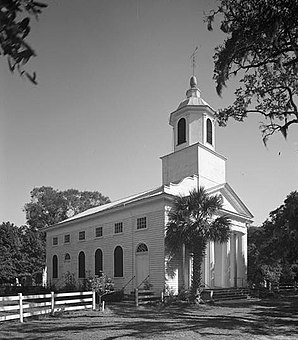
 Presbyterian Church of Edisto Island |
||
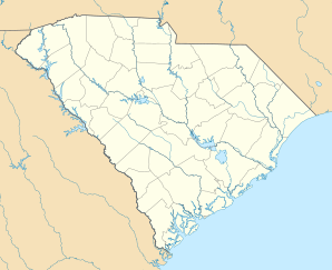
| Location in South Carolina | ||
|
|
||
| Basic data | ||
| State : | United States | |
| State : | South carolina | |
| Counties : |
Charleston County Colleton County |
|
| Coordinates : | 32 ° 34 ′ N , 80 ° 18 ′ W | |
| Time zone : | Eastern ( UTC − 5 / −4 ) | |
| Residents : | 2,301 (as of: 2000) | |
| Population density : | 13.1 inhabitants per km 2 | |
| Area : | 175.5 km 2 (approx. 68 mi 2 ) of which 175.1 km 2 (approx. 68 mi 2 ) is land |
|
| Height : | 3 m | |
| Postal code : | 29438 | |
| FIPS : | 45-23065 | |
| GNIS ID : | 1231262 | |
Edisto Island is one of the South Carolinas Sea Islands , the greater part of which is in Charleston County ; the southern tip of the island with Edisto Beach is in Colleton County , while the part of the island in Charleston County is unincorporated .
The island, city and the Edisto River were named after the Edistow, a sub-tribe of the Cusabo who no longer existed and who settled both the island and the surrounding mainland.
geography
Edisto Island is about 70 km southwest of Charleston , between the estuary of the Edisto River. The largely wooded marshland, criss-crossed by tides , is separated from Little Edisto Island to the north by Russel Creek . The two largest of these creeks, Store Creek and Ocella Creek, are connected to each other, so they are actually two islands.
On the island is the Edisto Island State Park with a campsite ; a supermarket and restaurants are nearby. The main road on the island is South Carolina Highway 174 . It is the only north-south connection and is 27 km long as a National Scenic Byway . With the exception of a four-lane section in Edisto Beach, the two-lane road is lined with evergreen oaks and small houses.
history
The natives occasionally used camps for fishing on the islands. The historical Edistow settled the island and the mainland of the area, where they traded with the Catawba . The sub-tribe died out in colonial times. The Wassamassaw tribe of Varnertown Indians is a group of descendants of different tribes who have mixed by marriage and inhabit a settlement between Summerville and Moncks Corner in Berkeley County, South Carolina and have been recognized by the state as one of six Indian groups since 2005 .
The first land tracts on the island on Edisto Island were given before 1700. Landowners first earned lumber and animal skins, planted indigo and some rice. They also kept free-range herds of cattle to produce hides for the European marrow and salt meat for the Caribbean. Little by little, cotton became the main agricultural product of the island's plantations, and after the revolution , the planters on Edisto Island became wealthy. They kept hundreds of enslaved Africans who communicated with each other in the Creole language Gullah and whose culture on the islands and in the Lowcountry of South Carolina is characteristic of their African customs.
The 1790 census found a population of 223 whites and 1,692 black slaves, and the 1860 census found 329 whites and 5,082 slaves.
Civil War
Edisto Island was largely abandoned by planters and farmers in November and December 1861, and escaped slaves set up their own refugee camps. In January 1862, island black armed men clashed with Confederate forces, and Confederate forces killed a small group of blacks in retaliation. Union troops were deployed on the island in February to prepare a staging area for future attacks on Charleston and to protect the colony that eventually consisted of thousands of blacks. When the Union troops took control of the island, there was some fighting before the Confederates withdrew. In June, most of the Union soldiers left the island to take part in a campaign that marked the battle of Secessionville . In July the remaining troops withdrew and the colony was relocated to St. Helena Island . For the remainder of the war, a small number of escaped slaves and plantations remained on the island, most of which were otherwise deserted. Towards the end of the war, freed slaves settled on the island.
Monument protection
During the 20th century the island has developed into a tourist destination.
The National Register of Historic Places includes: Alexander Bache US Coast Survey Line , Bailey's Store , Bleak Hall Plantation Outbuildings , Brick House Ruins , Brookland Plantation , Cassina Point , Crawford's Plantation House , Edisto Island Baptist Church , Edisto Island Presbyterian Church , Fig Island , Frogmore , Paul Grimball House Ruins , Hutchinson House , Middleton's Plantation , Oak Island , Old House Plantation , Peter's Point Plantation , Presbyterian Manse , Prospect Hill , William Seabrook House , Seaside School , Seaside Plantation House , Spanish Mount Point , Sunnyside , Hephzibah Jenkins Townsend's Tabby Oven Ruins , Trinity Episcopal Church , Wescott Road and Windsor Plantation .
Demographics
At the time of the United States Census 2000, Edisto Island (CCD) was inhabited by 1159 people. The population density was 59.6 people per km 2 . There were 819 housing units, an average of 31.3 per km 2 . The Edisto Island (CCD) population was 59.6% White , 39.1% Black or African American , 0.20% Native American , 0.0% Asian , 0% Pacific Islander , 0.6% reported belonging to other races and 0.5% named two or more races. 1.4% of the population declared to be Hispanic or Latinos of any race.
The residents of Edisto Island (CCD) s distributed to 1030 households out of which 31.5% were living in children under 18 years. 41.4% of households were married, 21.0% had a female head of the household without a husband and 33.4% were not families. 28.7% of households were made up of individuals and someone lived in 10.8% of all households aged 65 years or older. The average household size was 2.55 and the average family size was 3.16.
The population was divided into 27.0% minors, 9.4% 18–24 year olds, 27.8% 25–44 year olds, 22.3% 45–64 year olds and 13.4% aged 65 and over or more. The median age was 36 years. For every 100 women there were 91.8 men. For every 100 women over 18, there were 82.8 men.
The median household income in Edisto Iceland (CCD) was 23,438 US dollars and the median family income reached the amount of 26,083 US dollars. The median income for men was $ 28,053 compared to $ 30,278 for women. The per capita income was $ 21,364. 28.8% of the population and 24.4% of families had an income below the poverty line , of which 44.7% of minors and 25.1% of those aged 65 and over were affected.
Personalities
- James Jamerson , bass player and member of the Funk Brothers , was born here
- Micah Jenkins , Confederate Civil War General who was killed by fire from his own ranks in the Battle of the Wilderness
- Burnet Maybank III , owner of one of the largest private plantations on the island
- Patti LuPone , singer and actress on Broadway, spends the winter months on the island
supporting documents
- ↑ a b Bo Petersen, "Researchers explore local tribe's ties to legendary temple" , The Post and Courier, April 17, 2005, accessed December 14, 2011
- ↑ Bo Petersen, "Local tribe reclaims its roots, heritage" , April 17, 2005, accessed December 14, 2011
- ^ Paul Starobin: Madness Rules the Hour: Charleston, 1860 and the Mania for War ( English ), First. 1st edition, Public Affairs, April 11, 2017.
- ↑ Tomblin 2009, pp. 65-73, 85-86, 95
- ^ National Register Information System . In: National Register of Historic Places . National Park Service . Retrieved July 9, 2010.
- ↑ American Factfinder ( English ) United States Census Bureau. Retrieved May 6, 2018.
literature
- Tomblin, Barbara. Bluejackets and Contrabands: African Americans and the Union Navy . University Press of Kentucky, 2009. - via Project MUSE
