
Ems cycle path
| Ems cycle path | |
|---|---|

|
|
| overall length | 375 km |
| location |
|
| map | |

|
|
| Course of the Ems | |
| Starting point | Hövelhof |
| Target point | Emden |
| difficulty | light |
| ADFC certification | 4 out of 5 stars |
| Website URL | emsradweg.de |
The Emsradweg (also Ems-Radweg , sometimes officially called " EmsRadweg ") is a long - distance cycle path in North Rhine-Westphalia and Lower Saxony , which runs over a distance of 375 kilometers from the sources of the Ems between Holte-Stukenbrock Castle and Hövelhof to its mouth near Emden in the North Sea . It runs largely in the immediate vicinity of the Ems.
Quality of the bike paths
As a rule, the route leads over paved back roads or cycle paths away from main roads. The route is very varied: fields, forests, meadows and cities alternate. In the cities, the busy zones are avoided. The routing is also unproblematic here. In addition, the cities are definitely worth a visit. The quality of the Ems Cycle Path was awarded 4 stars by the ADFC in autumn 2008 .
Routing

The cyclist crosses a total of five holiday regions on his tour. Each has its peculiarity, so the Teutoburg Forest with its chain of hills offers good vantage points, in the Münsterland the path leads through the Emsauen and the northern part with the Emsland , East Friesland and the North Sea impresses with the vastness of the landscape and maritime flair.
The transformation of the Ems from a stream (in the Senne near Hövelhof) to a river (from Rietberg ) is particularly interesting . South of the city of Greven , near the village of Gimbte , the Ems is spanned by a historic canal overpass , which ensured the smooth shipping of the Dortmund-Ems Canal across the river until 1940. The Ems is navigable from Emsdetten , which is evident from Rheine at the latest .
In the southern Emsland , the Ems is looking for its way through moor and heather areas. Shortly before the city of Lingen (Ems) , the three watercourses Ems, Dortmund-Ems Canal and Ems-Vechte Canal cross . In Meppen the Ems merges with the little river Hase and the Dortmund-Ems Canal. Behind Papenburg and in the district of Leer , the Ems is subject to the influence of the ebb and flow of the North Sea and is continuously diked. There it can happen that the Ems suddenly flows “the wrong way around”.
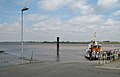
Anyone who drives beyond Emden to the coast (about at the height of Camping ) can see the transition from Ems to the North Sea by the vegetation on the banks (algae etc.).
Connecting routes

In some parts the Ems cycle path runs parallel to the Dortmund-Ems Canal Route .
Signage
The Ems cycle path is signposted in both directions. It is part of the national cycle path networks, which are signposted red and white in North Rhine-Westphalia and green and white in Lower Saxony. It often happens that different themed routes share the same section of the route. The different themed routes can be recognized by their symbols - the Ems cycle path is the green double E with a blue wave (see logo)
On the way, the cyclist will encounter two different types of signs:
Intermediate signposts: There are square intermediate signposts with a bicycle symbol and a directional arrow that provide information about the direction of travel where all cycle routes follow a route. Since these signs refer to all cycle routes of a section of the route, no symbols of the individual routes are shown on them.
Arrow signposts: At so-called intersections, where previously parallel cycle routes separate and are directed in different directions (e.g. at intersections), arrow signs point in the different directions. The symbols of the relevant themed route are attached to the lower edge. The signs also contain location and kilometer information for the different directions. Since two themed routes can lead to the same place on different paths, but do not necessarily meet there again, the cyclist should always pay attention to the symbol of the Ems cycle path and follow it. For reasons of space and safety, the sign posts of the arrow signposts can be on the right as well as on the left edge of the road, i.e. also on the opposite side of the street. This is particularly important when driving through built-up areas.
If there are no intermediate signs or arrow signs at an intersection or a junction, go straight ahead.
Elevation profile
The Ems cycle path has hardly any height differences and is therefore also suitable for families with children.
literature
- bikeline bike tour book "Ems-Radweg. From the source to Emden; with Dortmund-Ems-Kanal" . Verlag Esterbauer, 1: 75,000, 120 pages, ISBN 978-3-85000-041-3 .
- " EmsRadweg cycling map ". Publicpress Verlag, 2008, ISBN 978-3-89920-416-2
- ADFC -Kompaktspiralo, EmsRadweg. From Hövelhof to Emden, with Dortmund-Ems Canal , 1: 50,000, Bielefelder Verlag 2014, ISBN 978-3-87073-640-8
See also
- " EmsAuenWeg " - from Warendorf to Rheine
- List of long-distance cycle routes in Germany
Web links
- emsradweg.de (with GPS data for free download)
- Ems cycle path in the ADFC tour portal ( Memento from March 5, 2016 in the Internet Archive )
- Ems cycle path
- Part of the Ems cycle path in the Emsland
Individual evidence
photos

Source (seepage source) of the Ems (1989)

Ems in Wiedenbrück

The Ems just before Rheine

Emswiese near Haren, view of the Emslanddom

Papenburg, St. Antonius Church

Bascule bridge over the Ems at Leer Jann-Berghaus-Brücke

Ems near Weener
Ferry from Ditzum to Petkum


