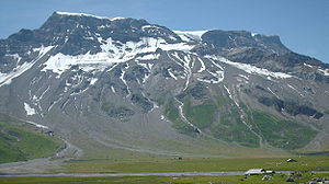
Engstligenalp

The Engstligenalp is the largest plateau in the western Swiss Alps . It is located south of Adelboden at 1900–2000 m above sea level. M. Since 1996 it has belonged to the cultural landscapes of national importance and since 2003 to the floodplain areas of national importance . An aerial cableway leads to Engstligenalp.
location
In the north it is bordered by the Fitzer , in the west by the Ammertenspitz and in the south-west by the dominant Wildstrubel , which is connected to the Steghorn , Tierhörnli, Chindbettihorn, Engstligengrat and Tschingellochtighorn in an easterly direction . In the northeast, the Ärtelengrat forms the border with Alp Hinterengstligen.
The valley level is an oval that extends north-south 1 km, east-west 2 km. It consists of flat alpine pasture, which is crossed by numerous mountain streams that arise on the slopes and valley edges. When valley exit they accumulate and fall on the two stages of the projected nature Engstligen almost 400 meters deep into Engstligental , where she Engstlige form.
From the north there is access by means of a mule track blasted into the rock through the 600 m high rock walls next to the Engstligen Falls.
To the southeast, the Chindbettipass leads west of the Chindbettihorn via Ueschinental to Kandersteg and via Rote Chumme and Gemmipass to Leukerbad in Valais . In the west, the Ämmertenpass leads between Wildstrubel and Ämmertenspitz to Lenk . Both passes are only used by mountain hikers today .
history
The Engstligenalp has been used as an alpine pasture since the late Middle Ages at the latest . It was first mentioned in a document in 1232 when knight Werner von Kien gave the Bishop of Sitten Landri de Mont the Alps "Entschligen" ( Latin : "Itenscigulam") and Gurnigel (Latin: "Gurnigulum") for a sum of "30 pounds Maurician coin" ( 30 St. Moritz pounds ). In 1373 Rudolf Grissie (Griessen) gave the bishop of Sion, Eduard of Savoyen-Achaia, the oath of fief for "a certain alp, called Enchiglin beyond the water Enchigle, with four tablets (alpine dairies)". Later Hensilinus, Egidius and Cuni Grisch (Griessen) are mentioned as fief holders. In 1494, Cuni Grieschen left the Entschligberg to the master sack master Anton Archer of Bern. In 1514 Cardinal Matthäus Schiner lent Ludwig Brüggler the Entschliglehen. In 1630 the fiefdom fell to Albert von Wattenwyl and remained in the family's possession until 1817. In 1657, 536 cows are said to have summered on the Alp.
Today's alpine economy
Today the Engstligenalp is owned by an alpine cooperative of around 100 farmers from Frutigen and some from Adelboden. On 700 hectares of pastureland, for around 10 weeks from the end of June to mid-September, it offers 500 head of cattle (around a third each of cows, cattle and calves) of the Simmental Fleckvieh breed and free exercise (due to the frequent night frosts, daytime grazing is in the foreground) .
Bernese alpine cheese is handcrafted from the milk of the cows (also sliced cheese after two years of storage ). The annual production is around 3500 kg for the entire alp, and is practically only sold privately or in Adelboden. The alpine lift in June is particularly spectacular, when 350 cows and cattle move on the mule path through the rock face at the Engstligen Falls up to the alp.
tourism
The Engstligenalp is also used for tourism . In summer, in addition to various mountain hiking routes, it offers an obstacle - free, wheelchair-accessible circular route (around 5 km), which, together with the corresponding facilities in the two guest houses, also enables disabled people to enjoy an unspoilt alpine world.
The Engstligenalp is the starting point for ski tours and mountain tours, for example on the Wildstrubel and the Steghorn or the Tschingellochtighorn , the Adelboden climbing mountain.
In winter there are two cross-country skiing trails with guaranteed snow and winter hiking trails in the valley floor, two baby lifts and several ski lifts on the north slope, which allow easy to difficult descents. One area is specially offered for freeride . In addition, there are options of various degrees of difficulty for tour riders .
Individual evidence
- ^ Fontes rerum Bernensium. Bern's historical sources. Second volume, covering the period from 1218, February, to 1271, July 6. J. Dalp'sche Buchhandlung (K. Schmid), Bern 1877. Section 119, p. 127 f. With the annotation: Copial book of the Val d'Illier in the Abbey of St. Maurice. P. 78.
- ^ Alfred Bärtschi: Adelboden. From the history of a mountain community . Bern 1934, chapter On the «common mountains» .
Web links
- engstligenalp.ch
- Engstligenalp alpine register
- Alpaufzug on Swiss television
- Documentary Alpaufzug (English)
Coordinates: 46 ° 26 '57 " N , 7 ° 33' 54" E ; CH1903: 609,709 / 144211


