Erpf (river)
| Erpf | ||
|
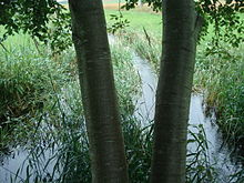
The Erpf in front of their mouth (downstream) |
||
| Data | ||
| Water code | DE : 11212 | |
| location |
Swabian Alb
|
|
| River system | Danube | |
| Drain over | Lauchert → Danube → Black Sea | |
| source |
Erpfquelle in Sonnenbühl- Erpfingen at Stettener Straße 26 48 ° 21 ′ 4 ″ N , 9 ° 11 ′ 31 ″ E |
|
| Source height | approx. 725 m above sea level NHN | |
| Spring discharge |
MNQ MQ MHQ |
1 l / s 60 l / s 500 l / s |
| muzzle | north and upstream of Burladingen- Stetten in the upper Lauchert coordinates: 48 ° 20 ′ 15 ″ N , 9 ° 10 ′ 59 ″ E 48 ° 20 ′ 15 ″ N , 9 ° 10 ′ 59 ″ E |
|
| Mouth height | approx. 701.1 m above sea level NHN | |
| Height difference | approx. 23.9 m | |
| Bottom slope | approx. 8 ‰ | |
| length | 3 km with a longer spring arm from the eastern edge of Erpfingen |
|
| Catchment area | 31.992 km² | |
The Erpf is a left tributary of the Lauchert in Baden-Württemberg .
geography
Erpfquelle

The Erpf rises in Erpfingen from a karst spring near the house at Stettener Straße 26. This is known under the name Brechlöchle, more rarely also whey spring. It is a dammed spring pool just north of the local thoroughfare in which the source with an average bulk of 60 l / s (min. 1 l / s max 500 l / s) flows. After less than a hundred meters in the village, the draining Molkebach reaches a longer source branch from the eastern edge of the village, which previously only had an open course there in sections.
course
The Erpf initially flows in a westerly direction, bends south and flows past the Erpfmühle north of Stetten into the Lauchert .

Protected areas
From around the inlet of the Molkenbach spring tributary in Erpfingen, the valley floor belongs to the Laucherttal nature reserve with side valleys . Almost the entire catchment area is located in water protection areas.
Web links
Individual evidence
LUBW
Official online waterway map with a suitable section and the layers used here: Course and catchment area of the Erpf
General introduction without default settings and layers: State Institute for the Environment Baden-Württemberg (LUBW) ( notes )
- ↑ Height according to the contour line image on the topographic map background layer .
- ↑ Height according to the gray lettering on the background layer topographic map .
- ↑ Length according to the waterway network layer ( AWGN ) .
- ↑ Catchment area after the layer aggregated areas 05 .
- ↑ Protected areas according to the relevant layers, nature partly according to the biotope layer .
Other evidence
- ↑ Friedrich Huttenlocher : Geographical Land Survey: The natural space units on sheet 178 Sigmaringen. Federal Institute for Regional Studies, Bad Godesberg 1959. → Online map (PDF; 4.3 MB)
- ↑ LUBW technical documents, Appendix LK Reutlingen p.155 (PDF file; 9.41 MB)
literature
- Topographic map 1: 25,000 Baden-Württemberg, as a single sheet
- for the river:
- No. 7621 Trochtelfingen
- for the rest of the catchment area:
- No. 7520 Mössingen, No. 7521 Reutlingen, No. 7620 Jungingen
- for the river:
Web links
- Map of the course and catchment area of the Erpf on: State Institute for the Environment Baden-Württemberg (LUBW) ( information )
- Map of the course and catchment area of the Erpf on: Geoportal Baden-Württemberg ( information )
- Measuring table sheets in the Deutsche Fotothek :
- 7520 Mössingen from 1911
- 7521 Reutlingen from 1908
- 7620 Talheim / Jungingen from 1910
- 7621 Trochtelfingen / Undingen from 1910
