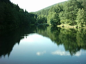
Udder lake
| Udder lake | |||||||||
|---|---|---|---|---|---|---|---|---|---|
| View from the dam to the north | |||||||||
|
|||||||||
|
|
|||||||||
| Coordinates | 49 ° 34 '20 " N , 9 ° 4' 26" E | ||||||||
| Data on the structure | |||||||||
| Construction time: | 1971 | ||||||||
| Crown length: | 24 m | ||||||||
| Data on the reservoir | |||||||||
| Water surface | 0.989 3 ha | ||||||||
| Reservoir length | 210 m | ||||||||
| Reservoir width | 65 m | ||||||||
The Eutersee near Oberzent - Schöllenbach is next to the Marbach reservoir the smaller of the two reservoirs in the Odenwald . Built in 1971 as a flood retention basin , it is also used for local recreation .
geography
The Eutersee is located a little northeast of the Hessian municipality of Oberzent-Schöllenbach, with its eastern part it already belongs to Baden-Württemberg . With an area of almost one hectare, it is already one of the larger still waters of the Odenwald. The reservoir is traversed in a north-south direction by the eponymous Euterbach , which joins the smaller right Schöllenbach to the Itterbach less than a kilometer after its outflow ; This is further down the valley then called Itter and flows into the Neckar at Eberbach .
Due to its location in the Kerbtal of the Euterbach, the Eutersee has an elongated contour. It is up to 210 m long and up to 65 m wide. The wooded eastern slope of the uninhabited valley extends in the upper lake to the shore, the western slope up to 25 m. On the outflow side, the valley opens up towards the settlement area of Badisch-Schöllenbach . Immediately behind the dam, meadows and other agricultural areas begin, through which a second drain runs to the left of the Euterbach, a mill ditch about half a kilometer long. It starts over the steep valley slopes in the east at 470– 490 m above sea level. NHN a plateau around Hesselbach , which in turn belongs to Hesse and which is at its eastern edge of 547.5 m above sea level. NHN high packages . The right edge height, formed as a spur by the Schöllenbach approaching at an acute angle, drops slightly southwards over a ridge at the level of the lake. At the eastern edge of lake runs a limited motorable road coming from the Baden-Schöllenbach circuitous as crate climb with a serpentine high up in Euterbachtal the slope in a straight line to the near right Hesselbach.
leisure
South of the lake about 300 m away on 11 hectares on the edge of the forest of Schöllenbach is a popular youth campsite, which is operated jointly by the Geo-Naturpark Bergstraße-Odenwald association and the municipality of Oberzent and which has up to 5000 overnight stays per year. On the northern edge of the lake there is a small beach, a lawn and a refuge . Due to the constant flow of cold mountain water, the water temperature of the Euteree only reaches 12-16 ° Celsius even in midsummer.
A fish ladder is set into the dam of the lake, which is also designated as an anglers , so that migrating fish can overcome the obstacle.
Individual evidence
LUBW
Official online waterway map with a suitable section and the layers used here: Map of Eutersee and the surrounding area
General introduction without default settings and layers: State Institute for the Environment Baden-Württemberg (LUBW) ( notes )
- ↑ a b Lake area after the layer standing waters , length and width measured on the background layer topographic map .
- ↑ Geographical description according to the background layer topographic map .
Other evidence
- ↑ Otto Klausing: Geographical land survey: The natural space units on sheet 151 Darmstadt. Federal Institute for Regional Studies, Bad Godesberg 1967. → Online map (PDF; 4.3 MB)
- ^ Hesseck - Schöllenbach district
literature
- Topographic map 1: 25,000 Baden-Württemberg, as a single sheet No. 6420 Mudau-Schönau
Web links
- Map of the Eutersee and its surroundings on: State Institute for the Environment Baden-Württemberg (LUBW) ( information )
- Hessenviewer (Geoportal Hessen) of the Hessian State Office for Soil Management and Geoinformation with property mapping ( notes )


