Ferbitz break
|
Ferbitz break
|
||
| location | Brandenburg , Germany | |
| surface | 1156.36 ha | |
| WDPA ID | 163045 | |
| Geographical location | 52 ° 30 ' N , 13 ° 1' E | |
|
|
||
| Setup date | April 16, 1996 | |
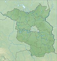
The Ferbitzer Bruch nature reserve lies in the area of the Havelland district and the city of Potsdam in Brandenburg . It is named after the Döberitz Heath located Wüstung Ferbitz .
Protected position
The Ferbitzer Bruch was declared a nature reserve in accordance with § 19 Paragraph 1 and 2 of the Brandenburg Nature Conservation Act of June 25, 1992 (GVBl. I p. 208) decreed by the Minister for the Environment, Nature Conservation and Regional Planning. The law came into force on April 16, 1996.
description
The 1156.36 hectare nature reserve, which was placed under nature protection by ordinance of April 16, 1996 , extends between Priort in the northwest, a district of the municipality of Wustermark , and Fahrland in the south, a district of Potsdam. The B 5 runs north of the area and the A 10 and the Havel Canal to the west .
The Ferbitzer Bruch borders the NSG Döberitzer Heide in the east and forms a large part of the natural experience ring zone , which is the part of Sielmann's natural landscape Döberitzer Heide accessible to hikers .
See also
- List of nature reserves in the Havelland district
- List of nature reserves in the city of Potsdam
- Döberitzer Heide # Nature reserve and natural landscape
Individual evidence
- ↑ Ordinance on the “Ferbitzer Bruch” nature reserve. Retrieved September 26, 2018 .


