Fourvière (hill)
| Fourvière | |
|---|---|
| administration | |
| country | France |
| region | Auvergne-Rhône-Alpes |
| circle | Metropolis of Lyon |
| city | Lyon |
| location | |
| Coordinates | 45 ° 45 ′ 45 ″ North 4 ° 49 ′ 18 ″ East |

|
|
The hill in the west that dominates the cityscape of Lyon is called Fourvière . This is also the name of the central district that is located on this hill. Jules Michelet calls the elevation the "mystical mountain". The district is the oldest settlement area in Lyons and was founded as the Roman city of Lugdunum on the foundations of a Celtic sanctuary dedicated to the god Lugh ( Lugdunum means "Hill of Lugh" ).
location
The Saône and then the Rhone flow from north to south along the last foothills of the Massif Central . The "Hill Fourvière" is part of a chain of hills along the Saône from Vaise to the confluence with the Rhône with a difference in altitude of up to 120 m; the absolute height of 318 m is reached in Fort de Sainte-Foy . It includes, from north to south, the districts of Saint-Irénée , Loyasse, Fourvière, Saint-Just and reaches the commune of Sainte-Foy-lès-Lyon to the south .
The Saône laps the foot of the hill where medieval and renaissance old Lyon is located.
From the top of the hill you have a view of the rose garden and old Lyon, behind it the Saône and the Lyon peninsula and further the Rhône with the districts of Les Brotteaux , la Part-Dieu , la Guillottière , Gerland and finally Monplaisir . On the outskirts of Lyon you can see the suburbs, over the plains of the Dauphiné the view extends to Bugey , the Chartreuse and the Alps .
This geographical location has a downside: the roads that lead up from Old Lyon are few and very steep ( montée Saint-Barthélémy , montée du Chemin-Neuf , montée de Choulans , montée des Épies ). One of the oldest climbs is the montée du Gourguillon . The ascent can also be done using various staircases, with a good view of the city ( montée des Chazeaux with a view of the Saint-Jean quarter and its Saint-Jean cathedral , montée du Garillan , montée du Change ).
The ascent is easier with the funiculars (French funiculaire ) Fourvière , Minimes and Saint-Just .
history
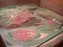
The Romans founded Lugdunum on the top of the hill. The forecourt of the basilica is where the old forum of the city, Forum Vetus, was located; this name changed in the course of time to Fourvière . Part of the forum slipped in a landslide in the 9th century. The present basilica stands on the old forum, in the heart of the Roman settlement.
Other upheavals have only recently taken place, including the most tragic of 1930 with 40 deaths on Tramassac Street. The cause was probably a water ingress. If one wants to follow an old popular belief, it is assumed that there is a lake in the underground of the hill.
Church window
A vow by the city council meant that the old chapel got a stained glass window designed by Lucien Bégule on behalf of Bossan in 1882 . The windows of the church above were ordered from another glazier by Louis Sainte-Marie-Perrin , Bossan's successor. The 5 glass windows in the crypt were made by Lucien Béguel in 1885.
Attractions
The "praying hill" has numerous archaeological and religious antiquities:
- The archaeological site of the ancient theater of Lyon , the ancient Odeon of Lyon and the pseudo-temple of Cybèle
- The Museum of Gallo-Roman Civilization (Lyon)
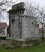
- The Roman mausoleum of Lyon (Tomb of Turbio), the arches of the Aqueduct of Greed and the thermal baths in the street des Farges and the fountain of the Cybèle
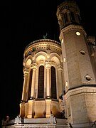
- 19th century Notre-Dame de Fourvière by Pierre Bossan
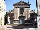
- Saint-Thomas chapel from the 18th century
- The Fourvière Ecclesiastical Art Museum in the Episcopal Palace
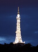
- The transmission tower on the Fourvière , the "petite Tour Eiffel" illuminated at night
- The former Saint Just seminary , now a state high school
- The 16th century church of Saint-Just
- The church of Saint-Irenee , one of the oldest churches in France with a crypt from the Carolingian period
- The rose garden below the basilica
- The Höhenpark with the "Bridge of the Four Winds"
- The Gourgillon rise connects Saint-Just with Saint-Jean. It is one of the oldest streets in Lyons, with its pavement and medieval houses (15th century) with windows decorated with animals. The half-timbered houses are rare in Lyon. You can see them in the Turquet cul-de-sac and the steep Gourguillon street . In the Middle Ages, the alley was called "Beauregard" because of the view of Lyon.
Notre-Dame de Fourvière and on the right the Saint-Thomas chapel
tunnel

Four tunnels cross the hill:
- The tunnel Saint-Irenee (2,109 m), between the Lyon-Vaise station and the Lyon Perrache station on the Paris-Marseille railway
- The tunnel de Loyasse between the train station Lyon-Saint-Paul to the train station Gorge-de-Loup on the railway line from Lyon-Saint-Paul to Montbrison
- The Tunnel de Fourvière motorway tunnel from Perrache to Tassin on the A6
- The tunnel of line D of the metro , from Saint-Jean to Vaise
Two railways lead up here, one from Vieux Lyon and one from Cathédrale Saint-Jean :
- The funiculaire F1 Saint-Jean - Minimes - Saint-Just with stops at the ancient theater and the Gallo-Roman museum
- The funiculaire F2 Saint-Jean - Fourvière , also called ficelle ("string"), which arrives on the terrace of the basilica.
Another connection ( ficelle ) existed between Saint-Paul and Fourvière, but that was abandoned.
Individual evidence
- ^ Jules Michelet, Le Banquet, 1878
- ↑ The Lyons say Saint-Ju
- ↑ In good weather you can see Mont Blanc .
- ↑ a b The Bégule windows can be viewed here.
- ↑ The expression (French: la colline qui prie) is intended as a counterpart to the opposite hill La Croix-Rousse , the working hill (la colline qui travaille). The origin of this name goes back to Jules Michelet , who wrote in Le Banquet in 1878 : "Je vis bien dès ce jour l'opposition des deux montagnes, de la montagne mystique et de celle du travail: mais je ne sentis pas leur guerre" ( Since that day I saw the contrast between the two mountains, the mystical mountain and that of work: but I did not feel their war / contrast.).
- ↑ From here you have a view of the Saône valley, the districts of Vaise and Duchère and the monts d'Or . This crossing is an old viaduct, over which a tram (la ficelle de Saint Paul) transported travelers but also coffins to the Loyasse cemetery .
Coordinates: 45 ° 46 ' N , 4 ° 49' E


