
Frisian woe
The Frisian Wehde is a flat ridge southwest of the Jade Bay .
Name and location
The term "Wehde" means forest ( mnd. Wede , and. Wido / wid u). The landscape was mentioned in 1420 as de Wede and in 1449 as den fresscken Weede .
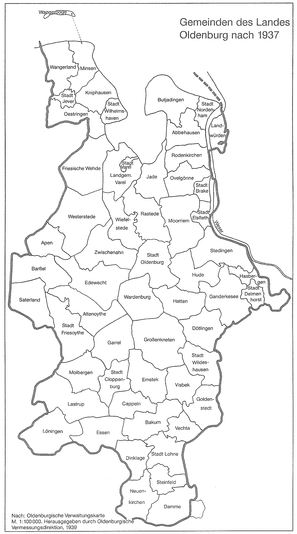
The Frisian Wehde is located in the district of Friesland in the area of the communities Bockhorn , Zetel and Varel . At a level of up to 15.6 m above sea level , it rises significantly above the marshland of the Jade Bay coast to the north and east , but hardly above the Uplengen Moor in the East Frisian inland to the south-west .
history
The Frisian Wehde may have been a large contiguous forest area in prehistoric times, possibly up to the early Middle Ages . It was settled by the advancing Frisians , but later also claimed by the Oldenburg counts . As a border fortress against the East Frisians and to protect the Frisian Wehde, Count Gerd the Brave of Oldenburg had the Neuchâtel built in 1462 .
Today, a little less than half of the Geest ridge is covered with forest, about as much as arable and pasture land. The Neuchâtel wood covers an area of 640 hectares . Its centerpiece is the Neuchâtel jungle , a nature reserve with mighty oaks and beeches . The abundant occurrence of clay , which is particularly suitable for the production of high-quality clinker , has led to the development of the world-famous brick industry , whose clay pits also require some space. Today the clinker manufacturers are united in the "United Klinkerwerke GmbH Bockhorn".
In 1933, the communities of Bockhorn, Zetel and Neuchâtel were merged to form the large community of Friesische Wehde, with the seat of the new community in Bockhorn. This happened analogously to the formation of the neighboring large community of Oestringen in the same year. In 1948, however, this large community was dissolved again and the three communities regained their independence. The municipality of Friesische Wehde comprised the farming communities of Astede, Blauhand, Bockhorn Nord, Bockhorn Süd, Bockhornerfeld, Bohlenberge, Bohlenbergerfeld, Bredehorn, Collstede-Astederfeld, Driefel, Ellens-Blauhand, Grabstede, Jührdenerfeld, Moorwinkelsdamm, Neuchâtel, Neuenburgerfeld, within the three mentioned municipalities. Ruttel, Schweinbrück, Steinhausen, Zetel east side, Zetel north side and Zetel west side. The population of the large municipality was 10,919 in 1933 and 11,912 in 1939.
literature
- Martin Bücking : Zeteler market. Novel of the Frisian Wehde . 1919. ISBN 978-3920602202 .
- Frisian Wehde - Bockhorn, Zetel, Neuchâtel, illustrated book . Bockhorn (Friesland) 1998.
Web links
Individual evidence
- ↑ Arend Remmers : From “Aaltukerei” to “Zwischenmooren”. The settlement names between Dollart and Jade. Verlag Schuster, Leer 2004, ISBN 3-7963-0359-5 , p. 75.