Fulde (river)
| Fulde | ||
|
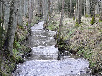
The Fulde in the "Eckernworth" |
||
| Data | ||
| location | in the district of Heidekreis , Lower Saxony | |
| River system | Weser | |
| Drain over | Böhme → Aller → Weser → North Sea | |
| source | at Walsrode -Ebbingen 52 ° 54 '16 " N , 9 ° 33' 19" O |
|
| Source height | 73 m above sea level NN | |
| muzzle | In Walsrode in the Bohemian Coordinates: 52 ° 51 '21 " N , 9 ° 35' 48" E 52 ° 51 '21 " N , 9 ° 35' 48" E |
|
| Mouth height | approx. 30 m above sea level NN | |
| Height difference | approx. 43 m | |
| Bottom slope | approx. 3.9 ‰ | |
| length | 11 km | |
| Catchment area | 31.2 km² | |
| Medium-sized cities | Walsrode | |
| Residents in the catchment area | approx. 7000 | |
The Fulde is an approx. 11 km long river in the river system of the Weser . It is located exclusively in the area of the city of Walsrode ( Heidekreis district , Lower Saxony ).
The river rises in a valley between two parallel terminal moraines from the penultimate Ice Age . By far the largest source branch drains the Grundlose Moor 4 kilometers north of Fulde and rises in the local small lake . Another rises 2.5 kilometers northwest of the village of Fulde, for which the stream was named. Afterwards the Fulde runs in a partly picturesque scenery with grass-covered loam shores and fish ponds south of the Walsroder Stadtwald Eckernworth with the Heidemuseum Rischmannshof , crosses the Fuldepark with the town hall in the core area of the city and flows south of the Klostersee into the Böhme .
literature
- Topographic map 1: 25000, sheet 3123. (Ed .: Land surveying and geographic base information Lower Saxony), Hanover 2002 (1st edition); ISBN 3-89435-220-5
annotation
This river should not be confused with the Fulda river , which also belongs to the Weser river system.
