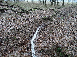
District ditch
| District ditch | ||
|
The district ditch at St.2307 between Schimborn and Feldkahl |
||
| Data | ||
| location |
Spessart
|
|
| River system | Rhine | |
| Drain over | Feldkahl → Kahl → Main → Rhine → North Sea | |
| source | northwest of Feldkahl 50 ° 2 ′ 48 ″ N , 9 ° 12 ′ 2 ″ E |
|
| Source height | 250 m above sea level NHN | |
| muzzle | at St. 2307 in Feldkahl Coordinates: 50 ° 2 '47 " N , 9 ° 11' 45" E 50 ° 2 '47 " N , 9 ° 11' 45" E |
|
| Mouth height | 195 m above sea level NHN | |
| Height difference | 55 m | |
| Bottom slope | 18% | |
| length | 300 m | |
| Catchment area | 7.5 ha | |
The district ditch is a right tributary of the Feldkahl in the district of Aschaffenburg in the Bavarian Spessart .
geography
course
The district ditch rises northwest of Feldkahl . It flows as a border stream between the districts of Feldkahl and Schimborn in a westerly direction and flows into the Feldkahl at state road 2307 .
Kahl river system
See also
Web links
Commons : Gemarkungsgraben - Collection of images, videos and audio files
