Feldkahl (river)
| Field bald | ||
|
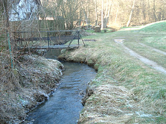
The Feldkahl in Schimborn |
||
| Data | ||
| location |
Spessart
|
|
| River system | Rhine | |
| Drain over | Kahl → Main → Rhine → North Sea | |
| source | in Rottenberg 50 ° 2 ′ 44 ″ N , 9 ° 14 ′ 14 ″ E |
|
| Source height | 325 m above sea level NHN | |
| muzzle | in Schimborn in the left arm of the Kahl coordinates: 50 ° 3 ′ 26 ″ N , 9 ° 11 ′ 19 ″ E 50 ° 3 ′ 26 ″ N , 9 ° 11 ′ 19 ″ E |
|
| Mouth height | 174 m above sea level NHN | |
| Height difference | 151 m | |
| Bottom slope | 27 ‰ | |
| length | 5.7 km | |
| Catchment area | 6.9 km² | |
| Left tributaries | Seewiesenbach , Folzbach | |
| Right tributaries | Biesigbach , Rohrchetsbach , Scherengrundbach , Gossengraben , Gemarkungsgraben | |
|
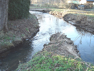
Muzzle of the Feldkahl (left) into the left arm of the Kahl (right) |
||
The Feldkahl is a left tributary of the Kahl in the Aschaffenburg district in the Bavarian Spessart .
Surname
The name Feldkahl comes from the Middle High German word vëlt , which means field . This refers to the fields in the headwaters of the stream. For the origin of the word Kahl see Name of Kahl . The brook gave the place Feldkahl its name.
geography
Field origin
The origin of the field bald is in the forest above the town of Rottenberg , a part of the municipality of Hösbach . Your source is located at 325 m above sea level. NHN between Klosterberg (381 m) and Rottenberg (408 m) at the hiking home, near the outdoor swimming pool. This layer source arises between the geological layers of the Zechstein and the Buntsandstein . The origin of the field bald spots is dry for most of the year. Only shortly before Rottenberg does water collect on the lake meadow.
At the fountain there is a boulder with the writing “Feldkahlursprung” and a miniature castle. This was built in 1936 from stones from the Odenwald . The spring water fills the moat and was used as a water supply for the forest house until the end of the 1960s. After the castle was badly damaged by a storm in August 2008, the system and the water inlets were redesigned.
course
After its source, the Feldkahl flows through some gardens in the Seewiese towards the southwest. In Rottenberg it is piped. She reaches the village of Feldkahl , named after her , where she takes in some tributaries. Then it crosses under the State Road 2307 . Between Feldkahl and Schimborn , the brook used to run the Feldkahler Mill, which is no longer in existence . At the location at the time, it crosses the municipal boundary to Mömbris .
Then the Folzbach coming from Daxberg joins from the left and the Feldkahl is passed under the state road 2305 . In Schimborn it is diverted from its original stream bed with the help of a weir and is used to irrigate the surrounding gardens. 200 m west of its actual mouth, it flows after a total length of 5.7 km near the Obermühle into a left arm of the Kahl .
Tributaries
- Biesigbach ( right )
- Rohrchetsbach ( right )
- Seewiesenbach ( left )
- Scherengrundbach ( right )
- Gossengraben ( right )
- District ditch ( right )
- Folzbach ( left )
Kahl river system
history
Mills
- Feldkahler Mill
See also the list of mills in the Kahlgrund .
See also
Web links
Individual evidence
- ↑ a b c d BayernAtlas of the Bavarian State Government ( notes )
- ↑ Our Kahlgrund 1980 . Homeland yearbook for the Alzenau district. Published by the working group for homeland research and homeland maintenance of the Alzenau district, district administrator. ISSN 0933-1328 .
- ↑ Information board at the point of origin
- ↑ Information board at the miniature castle
- ↑ a b c d e f Our Kahlgrund 2013 . Homeland yearbook for the Alzenau district. Published by the working group for homeland research and homeland maintenance of the Alzenau district, district administrator. ISSN 0933-1328 .


